Area Overview for CM3 8DN
Photos of CM3 8DN


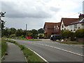
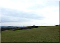


10 photos from this area
Area Information
Key information about the CM3 8DN including its size, population, and administrative classification.
- Area Type
- Postcode
- Area Size
- 31.1 hectares
- Population
- 1651
- Population Density
- 356 people/km²
House Prices in CM3 8DN
12
Properties
£844,500
Average Sold Price
£439,000
Lowest Price
£1,250,000
Highest Price
Showing 12 properties
| Address | Type | Beds | Baths | Last Sale Price | Last Sale Date | |
|---|---|---|---|---|---|---|
| Rettendon Old Hall, Main Road, Rettendon, Chelmsford, CM3 8DN | Bungalow | 1 | - | £1,250,000 | Mar 2016 | |
| Wyndham, Main Road, Rettendon, Chelmsford, CM3 8DN | Detached | 4 | 2 | £439,000 | Jul 2013 | |
| 2, Hall Cottages, Main Road, Rettendon, Chelmsford, CM3 8DN | Bungalow | 3 | 1 | - | - | |
| Land North Of Old Hall Barns, Main Road, Rettendon, Chelmsford, CM3 8DN | Leisure | - | - | - | - | |
| The Barnes, Old Hall Farm, Main Road, Rettendon, Chelmsford, CM3 8DN | house | - | - | - | - | |
| The Barns, Rettendon Old Hall, Main Road, Rettendon, Chelmsford, CM3 8DN | undefined | - | - | - | - | |
| Caravan At, Old Hall Farm, Main Road, Rettendon, Chelmsford, CM3 8DN | Mobile Home | - | - | - | - | |
| Log Cabin At, Old Hall Farm, Main Road, Rettendon, Chelmsford, CM3 8DN | Detached | - | - | - | - | |
| The Bungalow, Old Hall Farm, Main Road, Rettendon, Chelmsford, CM3 8DN | Bungalow | 1 | - | - | - | |
| 3A The Barns At, Old Hall Farm, Main Road, Rettendon, Chelmsford, CM3 8DN | Office | - | - | - | - |
Page 1 of 2
Energy Efficiency in CM3 8DN
Amenities
Schools
| Rank | School | Type | Entry gender | Ages |
|---|
Explore more schools in this area
Go to Schools tabDemographics
Household Size
Family (3-5 people)
most common
Accommodation Type
Houses
most common
Tenure
71
majority
Ethnic Group
White
most common
Religion
N/A
most common
Household Composition
N/A
most common
Age
47
median
Adults (30-64 years)
most common
Household Deprivation
N/A
with no deprivation
NS-SEC
38
in Lower managerial occupations
Explore more demographic insights in this area
Go to Demographics tabPlanning
Planning Constraints
- Flood RiskPremium
- Ramsar Wetland SitesPremium
- Area of Outstanding Natural BeautyPremium
- Protected Nature ReservePremium
- Protected WoodlandPremium