Area Overview for CM3 6BE
Photos of CM3 6BE
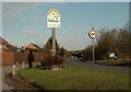
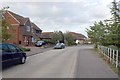
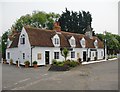
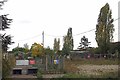
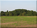
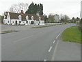
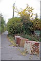
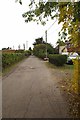
8 photos from this area
Area Information
Key information about the CM3 6BE including its size, population, and administrative classification.
- Area Type
- Postcode
- Area Size
- 6.8 hectares
- Population
- 1128
- Population Density
- 260 people/km²
House Prices in CM3 6BE
16
Properties
£426,500
Average Sold Price
£238,500
Lowest Price
£575,000
Highest Price
Showing 16 properties
| Address | Type | Beds | Baths | Last Sale Price | Last Sale Date | |
|---|---|---|---|---|---|---|
| 17 Steeple Road, Mayland, CM3 6BE | Detached | 4 | 2 | £523,000 | Oct 2024 | |
| The Gaps, 9 Steeple Road, Mayland, CM3 6BE | Detached | 5 | 2 | £575,000 | Sep 2024 | |
| Glandore, 13 Steeple Road, Mayland, CM3 6BE | house | - | - | £470,000 | Dec 2022 | |
| The Owls, 31 Steeple Road, Mayland, CM3 6BE | Bungalow | 4 | - | £402,500 | May 2017 | |
| Davina Lodge, 27 Steeple Road, Mayland, CM3 6BE | Detached | - | - | £350,000 | Nov 2006 | |
| Alberta, 29 Steeple Road, Mayland, CM3 6BE | Detached | 3 | 1 | £238,500 | May 2003 | |
| Quercus Rise, Steeple Road, Mayland, CM3 6BE | Bungalow | 4 | 2 | - | - | |
| The Granary, 33 Steeple Road, Mayland, CM3 6BE | Detached | 4 | 2 | - | - | |
| Tally Ho Cottage, Steeple Road, Mayland, CM3 6BE | Bungalow | 3 | - | - | - | |
| Genis Laval, 21A Steeple Road, Mayland, CM3 6BE | Detached | - | - | - | - |
Page 1 of 2
Energy Efficiency in CM3 6BE
Amenities
Schools
| Rank | School | Type | Entry gender | Ages |
|---|
Explore more schools in this area
Go to Schools tabDemographics
Household Size
Family (3-5 people)
most common
Accommodation Type
Houses
most common
Tenure
76
majority
Ethnic Group
White
most common
Religion
N/A
most common
Household Composition
N/A
most common
Age
47
median
Adults (30-64 years)
most common
Household Deprivation
N/A
with no deprivation
NS-SEC
31
in Lower managerial occupations
Explore more demographic insights in this area
Go to Demographics tabPlanning
Planning Constraints
- Flood RiskPremium
- Ramsar Wetland SitesPremium
- Area of Outstanding Natural BeautyPremium
- Protected Nature ReservePremium
- Protected WoodlandPremium