Area Overview for CM3 4RA
Photos of CM3 4RA
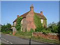
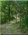
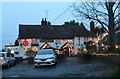
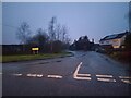
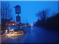
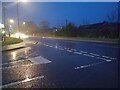
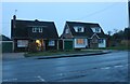
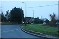
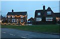
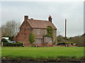
15 photos from this area
Area Information
Key information about the CM3 4RA including its size, population, and administrative classification.
- Area Type
- Postcode
- Area Size
- 1.3 hectares
- Population
- 1940
- Population Density
- 393 people/km²
House Prices in CM3 4RA
15
Properties
£771,250
Average Sold Price
£475,000
Lowest Price
£970,000
Highest Price
Showing 15 properties
| Address | Type | Beds | Baths | Last Sale Price | Last Sale Date | |
|---|---|---|---|---|---|---|
| 130 Maldon Road, Danbury, Chelmsford, CM3 4RA | house | - | - | £840,000 | May 2024 | |
| 96 Maldon Road, Danbury, Chelmsford, CM3 4RA | house | - | - | £475,000 | Apr 2023 | |
| 120 Maldon Road, Danbury, Chelmsford, CM3 4RA | Bungalow | - | - | £970,000 | Sep 2022 | |
| 126 Maldon Road, Danbury, Chelmsford, CM3 4RA | Detached | 5 | 2 | £800,000 | Aug 2017 | |
| 116 Maldon Road, Danbury, Chelmsford, CM3 4RA | Retail | - | - | - | - | |
| 100 Maldon Road, Danbury, Chelmsford, CM3 4RA | house | - | - | - | - | |
| 98 Maldon Road, Danbury, Chelmsford, CM3 4RA | Semi-detached | - | - | - | - | |
| 104 Maldon Road, Danbury, Chelmsford, CM3 4RA | house | - | - | - | - | |
| 102 Maldon Road, Danbury, Chelmsford, CM3 4RA | Semi-detached | - | - | - | - | |
| 108 Maldon Road, Danbury, Chelmsford, CM3 4RA | Semi-detached | - | - | - | - |
Page 1 of 2
Energy Efficiency in CM3 4RA
Amenities
Schools
| Rank | School | Type | Entry gender | Ages |
|---|
Explore more schools in this area
Go to Schools tabDemographics
Household Size
Two person
most common
Accommodation Type
Houses
most common
Tenure
91
majority
Ethnic Group
White
most common
Religion
N/A
most common
Household Composition
N/A
most common
Age
47
median
Adults (30-64 years)
most common
Household Deprivation
N/A
with no deprivation
NS-SEC
48
in Lower managerial occupations
Explore more demographic insights in this area
Go to Demographics tabPlanning
Planning Constraints
- Flood RiskPremium
- Ramsar Wetland SitesPremium
- Area of Outstanding Natural BeautyPremium
- Protected Nature ReservePremium
- Protected WoodlandPremium