Area Overview for CM3 4DS
Photos of CM3 4DS
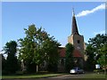
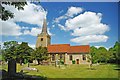
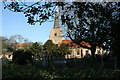
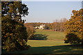
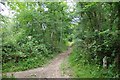
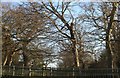
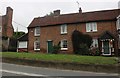
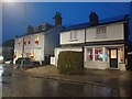

30 photos from this area
Area Information
Key information about the CM3 4DS including its size, population, and administrative classification.
- Area Type
- Postcode
- Area Size
- 9.1 hectares
- Population
- 1741
- Population Density
- 265 people/km²
House Prices in CM3 4DS
26
Properties
£598,594
Average Sold Price
£130,000
Lowest Price
£1,175,000
Highest Price
Showing 26 properties
| Address | Type | Beds | Baths | Last Sale Price | Last Sale Date | |
|---|---|---|---|---|---|---|
| Friars, Riffhams Lane, Danbury, Chelmsford, CM3 4DS | house | 5 | 2 | £955,000 | Jun 2025 | |
| Fir Trees, Riffhams Lane, Danbury, Chelmsford, CM3 4DS | house | - | - | £1,060,000 | Sep 2022 | |
| Needles, Riffhams Lane, Danbury, Chelmsford, CM3 4DS | house | 4 | 2 | £740,000 | Jun 2021 | |
| Ivy Cottage, Riffhams Lane, Danbury, Chelmsford, CM3 4DS | house | - | - | £380,000 | Mar 2021 | |
| Rosedene, Riffhams Lane, Danbury, Chelmsford, CM3 4DS | Detached | 5 | 5 | £1,175,000 | Jul 2019 | |
| Hazeleigh, Riffhams Lane, Danbury, Chelmsford, CM3 4DS | Detached | 4 | 3 | £750,000 | May 2019 | |
| Ramor, Riffhams Lane, Danbury, Chelmsford, CM3 4DS | house | - | - | £720,000 | Mar 2017 | |
| Hunters Lodge, Riffhams Lane, Danbury, Chelmsford, CM3 4DS | Detached | 4 | 2 | £535,000 | Jun 2015 | |
| Silverdale, Riffhams Lane, Danbury, Chelmsford, CM3 4DS | Detached | 4 | 1 | £550,000 | Jun 2015 | |
| Skerries, Riffhams Lane, Danbury, Chelmsford, CM3 4DS | Detached | 5 | 2 | £730,000 | Mar 2015 |
Page 1 of 3
Energy Efficiency in CM3 4DS
Amenities
Schools
| Rank | School | Type | Entry gender | Ages |
|---|
Explore more schools in this area
Go to Schools tabDemographics
Household Size
Two person
most common
Accommodation Type
Houses
most common
Tenure
92
majority
Ethnic Group
White
most common
Religion
N/A
most common
Household Composition
N/A
most common
Age
47
median
Adults (30-64 years)
most common
Household Deprivation
N/A
with no deprivation
NS-SEC
55
in Lower managerial occupations
Explore more demographic insights in this area
Go to Demographics tabPlanning
Planning Constraints
- Flood RiskPremium
- Ramsar Wetland SitesPremium
- Area of Outstanding Natural BeautyPremium
- Protected Nature ReservePremium
- Protected WoodlandPremium