Area Overview for CM3 4AJ
Photos of CM3 4AJ
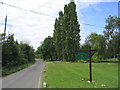
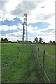
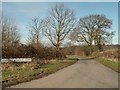
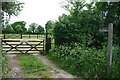
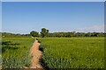
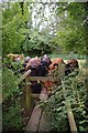
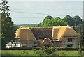
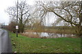
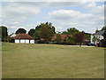
9 photos from this area
Area Information
Key information about the CM3 4AJ including its size, population, and administrative classification.
- Area Type
- Postcode
- Area Size
- 66.6 hectares
- Population
- 1535
- Population Density
- 146 people/km²
House Prices in CM3 4AJ
15
Properties
£560,000
Average Sold Price
£290,000
Lowest Price
£830,000
Highest Price
Showing 15 properties
| Address | Type | Beds | Baths | Last Sale Price | Last Sale Date | |
|---|---|---|---|---|---|---|
| Sporhams Farm House, Sporhams Lane, Sandon, Chelmsford, CM3 4AJ | Detached | 5 | - | £830,000 | Jan 2022 | |
| Middle Ford, Sporhams Lane, Sandon, Chelmsford, CM3 4AJ | Detached | - | - | £290,000 | Apr 2007 | |
| Chamberlains House, Sporhams Lane, Sandon, Chelmsford, CM3 4AJ | Detached | 4 | - | - | - | |
| Sporhams Orchard, Sporhams Lane, Sandon, Chelmsford, CM3 4AJ | Land | 5 | 2 | - | - | |
| 1, Chamberlains Cottages, Sporhams Lane, Sandon, Chelmsford, CM3 4AJ | Detached | 5 | - | - | - | |
| Hillcrest, Sporhams Lane, Sandon, Chelmsford, CM3 4AJ | Detached | 5 | - | - | - | |
| Flat Chamberlains Farm, Sporhams Lane, Sandon, Chelmsford, CM3 4AJ | Flat | - | - | - | - | |
| Tennis 43M From Middle Ford, Sporehams Lane 19M From Unnamed Road, Sporhams Lane, Sandon, Chelmsford, CM3 4AJ | Leisure | - | - | - | - | |
| Annexe At Hillcrest, Sporhams Lane, Danbury, Chelmsford, CM3 4AJ | Semi-detached | - | - | - | - | |
| Thorn Farm, Sporhams Lane, Sandon, Chelmsford, CM3 4AJ | Farm | - | - | - | - |
Page 1 of 2
Energy Efficiency in CM3 4AJ
Amenities
Schools
| Rank | School | Type | Entry gender | Ages |
|---|
Explore more schools in this area
Go to Schools tabDemographics
Household Size
Family (3-5 people)
most common
Accommodation Type
Houses
most common
Tenure
84
majority
Ethnic Group
White
most common
Religion
N/A
most common
Household Composition
N/A
most common
Age
47
median
Adults (30-64 years)
most common
Household Deprivation
N/A
with no deprivation
NS-SEC
45
in Lower managerial occupations
Explore more demographic insights in this area
Go to Demographics tabPlanning
Planning Constraints
- Flood RiskPremium
- Ramsar Wetland SitesPremium
- Area of Outstanding Natural BeautyPremium
- Protected Nature ReservePremium
- Protected WoodlandPremium