Area Overview for CM3 2DB
Photos of CM3 2DB
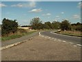
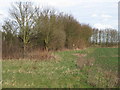
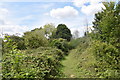
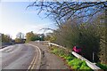
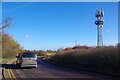
18 photos from this area
Area Information
Key information about the CM3 2DB including its size, population, and administrative classification.
- Area Type
- Postcode
- Area Size
- 1.7 hectares
- Population
- 1442
- Population Density
- 1237 people/km²
House Prices in CM3 2DB
24
Properties
£441,769
Average Sold Price
£139,000
Lowest Price
£790,000
Highest Price
Showing 24 properties
| Address | Type | Beds | Baths | Last Sale Price | Last Sale Date | |
|---|---|---|---|---|---|---|
| 4 The Pines, Hatfield Peverel, CM3 2DB | house | 4 | 3 | £625,000 | Feb 2025 | |
| Thornwood, The Pines, Hatfield Peverel, CM3 2DB | Detached | 5 | 2 | £790,000 | Oct 2023 | |
| Melford, The Pines, Hatfield Peverel, CM3 2DB | house | - | - | £740,000 | Aug 2022 | |
| 13 The Pines, Hatfield Peverel, CM3 2DB | house | - | - | £560,000 | Jun 2021 | |
| 9 The Pines, Hatfield Peverel, CM3 2DB | house | - | - | £555,000 | Dec 2020 | |
| 8 The Pines, Hatfield Peverel, CM3 2DB | Detached | 4 | - | £397,000 | Oct 2015 | |
| 1 The Pines, Hatfield Peverel, CM3 2DB | Detached | 4 | - | £425,000 | Jan 2011 | |
| 10 The Pines, Hatfield Peverel, CM3 2DB | Detached | - | - | £345,000 | Sep 2008 | |
| 17 The Pines, Hatfield Peverel, CM3 2DB | Detached | - | - | £318,000 | Apr 2007 | |
| Cedar Lodge, The Pines, Hatfield Peverel, CM3 2DB | Detached | - | - | £535,500 | Oct 2006 |
Page 1 of 3
Energy Efficiency in CM3 2DB
Amenities
Schools
| Rank | School | Type | Entry gender | Ages |
|---|
Explore more schools in this area
Go to Schools tabDemographics
Household Size
Two person
most common
Accommodation Type
Houses
most common
Tenure
61
majority
Ethnic Group
White
most common
Religion
N/A
most common
Household Composition
N/A
most common
Age
47
median
Adults (30-64 years)
most common
Household Deprivation
N/A
with no deprivation
NS-SEC
36
in Lower managerial occupations
Explore more demographic insights in this area
Go to Demographics tabPlanning
Planning Constraints
- Flood RiskPremium
- Ramsar Wetland SitesPremium
- Area of Outstanding Natural BeautyPremium
- Protected Nature ReservePremium
- Protected WoodlandPremium