Area Overview for CM3 1DL
Photos of CM3 1DL
Area Information
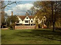
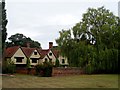
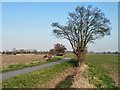
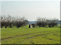
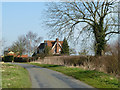
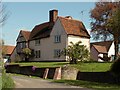
Living in CM3 1DL means being part of a small, tightly knit residential cluster in Essex’s Chelmsford district. With a population of 1,373 and a density of 73 people per square kilometre, this area retains a village-like character despite its proximity to urban centres. Nestled in Great Waltham, a civil parish spanning 6,147 acres, CM3 1DL is defined by its historic roots, including the 16th-century Badynghams building (locally known as the Guildhall) and the parish church with a bell cast in 1336. The area’s charm lies in its blend of rural tranquillity and practical connectivity, with the River Chelmer nearby and easy access to rail networks. Residents benefit from a low crime risk score of 82 and no significant environmental constraints, making it a stable choice for families and professionals seeking a balanced lifestyle. The presence of Ford End Church of England Primary School, rated ‘good’ by Ofsted, further underscores the area’s appeal for households prioritising education.
- Area Type
- Postcode
- Area Size
- Not available
- Population
- 1373
- Population Density
- 73 people/km²
The property market in CM3 1DL is characterised by high home ownership (70%) and a focus on houses rather than flats or apartments. This suggests a market skewed towards owner-occupied homes, likely catering to families and long-term residents. The absence of rental data implies limited availability of lettings, which could make the area more attractive to buyers seeking stability. Given the small postcode area and its integration with Great Waltham’s villages and hamlets, properties here are likely to be of traditional or semi-detached design, reflecting the parish’s historic and rural nature. Buyers should consider the limited size of the area, which may mean competition for available homes. The combination of low crime risk and proximity to rail links adds to the area’s desirability for those prioritising safety and connectivity.
House Prices in CM3 1DL
No properties found in this postcode.
Energy Efficiency in CM3 1DL
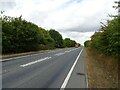
The lifestyle in CM3 1DL is shaped by its proximity to retail hubs and transport links. Nearby amenities include M&S Broomfield, Waitrose Little, and Morrisons Chelmsford, offering a range of shopping and dining options within practical reach. The area’s village atmosphere is complemented by access to historic landmarks such as the parish church and Badynghams, which provide cultural and recreational value. The River Chelmer adds a natural element to daily life, while the nearby rail stations ensure easy access to urban centres. The presence of a bus interchange further enhances mobility, allowing residents to explore surrounding areas effortlessly. This blend of rural tranquillity and urban connectivity makes CM3 1DL suitable for those seeking convenience without sacrificing a sense of community.
Amenities
Schools
The nearest school to CM3 1DL is Ford End Church of England Primary School, which serves the local community with a ‘good’ Ofsted rating. This school is the only educational institution explicitly listed in the data, indicating that primary education is readily available within the area. However, families requiring secondary schooling may need to look further afield, as no secondary schools are mentioned. The presence of a well-rated primary school enhances the area’s appeal for households with young children, offering a reliable foundation for early education. The school’s rating suggests a focus on quality teaching and facilities, which aligns with the broader stability and low-risk profile of CM3 1DL.
| Rank | School | Type | Entry gender | Ages |
|---|---|---|---|---|
| 1 | Ford End Church of England Primary School | primary | N/A | N/A |
| 2 | Ford End Church of England Primary School | primary | N/A | N/A |
Explore more schools in this area
Go to Schools tabDemographics
The community in CM3 1DL is predominantly composed of adults aged 30–64, with a median age of 47. This suggests a mature, established population, likely drawn to the area’s stability and historical character. Home ownership is high, at 70%, with houses being the primary accommodation type. The predominant ethnic group is White, reflecting a homogenous demographic profile. The population density of 73 people per square kilometre indicates a low-rise, spread-out settlement pattern typical of rural parishes. While no specific deprivation data is provided, the high home ownership rate and absence of environmental constraints suggest a relatively affluent, low-risk environment. This profile aligns with the area’s appeal to families and professionals seeking a quiet, well-connected location without the pressures of dense urban living.
Household Size
Accommodation Type
Tenure
Ethnic Group
Religion
Household Composition
Age
Household Deprivation
NS-SEC
Explore more demographic insights in this area
Go to Demographics tabPlanning
Planning Constraints
- Flood RiskPremium
- Ramsar Wetland SitesPremium
- Area of Outstanding Natural BeautyPremium
- Protected Nature ReservePremium
- Protected WoodlandPremium
- Crime RiskPremium