Area Overview for CM23 4LL
Photos of CM23 4LL

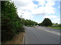
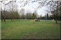
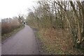
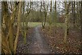

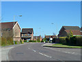
7 photos from this area
Area Information
Key information about the CM23 4LL including its size, population, and administrative classification.
- Area Type
- Postcode
- Area Size
- 1.0 hectares
- Population
- 1363
- Population Density
- 3719 people/km²
House Prices in CM23 4LL
18
Properties
£405,050
Average Sold Price
£133,000
Lowest Price
£755,000
Highest Price
Showing 18 properties
| Address | Type | Beds | Baths | Last Sale Price | Last Sale Date | |
|---|---|---|---|---|---|---|
| 12 Larkspur Close, Bishops Stortford, CM23 4LL | Detached | 4 | 2 | £755,000 | Sep 2025 | |
| 7 Larkspur Close, Bishops Stortford, CM23 4LL | Detached | 4 | 2 | £732,500 | Dec 2023 | |
| 2 Larkspur Close, Bishops Stortford, CM23 4LL | Detached | 4 | 2 | £732,500 | Aug 2023 | |
| 6 Larkspur Close, Bishops Stortford, CM23 4LL | Detached | 4 | 2 | £555,000 | Jan 2020 | |
| 1 Larkspur Close, Bishops Stortford, CM23 4LL | Detached | 4 | - | £618,000 | Jun 2018 | |
| 17 Larkspur Close, Bishops Stortford, CM23 4LL | Detached | 4 | - | £492,500 | Nov 2014 | |
| Oaks Reach, 9 Larkspur Close, Bishops Stortford, CM23 4LL | house | - | - | £545,000 | Jul 2012 | |
| 18 Larkspur Close, Bishops Stortford, CM23 4LL | house | - | - | £426,500 | May 2011 | |
| 15 Larkspur Close, Bishops Stortford, CM23 4LL | Detached | - | - | £435,000 | Apr 2007 | |
| 13 Larkspur Close, Bishops Stortford, CM23 4LL | Detached | - | - | £380,000 | Sep 2006 |
Page 1 of 2
Energy Efficiency in CM23 4LL
Amenities
Schools
| Rank | School | Type | Entry gender | Ages |
|---|
Explore more schools in this area
Go to Schools tabDemographics
Household Size
Family (3-5 people)
most common
Accommodation Type
Houses
most common
Tenure
79
majority
Ethnic Group
White
most common
Religion
N/A
most common
Household Composition
N/A
most common
Age
47
median
Adults (30-64 years)
most common
Household Deprivation
N/A
with no deprivation
NS-SEC
46
in Lower managerial occupations
Explore more demographic insights in this area
Go to Demographics tabPlanning
Planning Constraints
- Flood RiskPremium
- Ramsar Wetland SitesPremium
- Area of Outstanding Natural BeautyPremium
- Protected Nature ReservePremium
- Protected WoodlandPremium