Area Overview for CM23 4AS
Photos of CM23 4AS
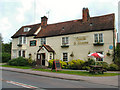

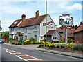


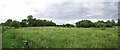

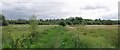
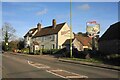
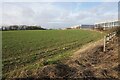
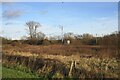

19 photos from this area
Area Information
Key information about the CM23 4AS including its size, population, and administrative classification.
- Area Type
- Postcode
- Area Size
- 11.6 hectares
- Population
- 1545
- Population Density
- 889 people/km²
House Prices in CM23 4AS
24
Properties
£374,855
Average Sold Price
£87,500
Lowest Price
£595,000
Highest Price
Showing 24 properties
| Address | Type | Beds | Baths | Last Sale Price | Last Sale Date | |
|---|---|---|---|---|---|---|
| Old Police Cottage, Thorley Street, Thorley, Bishops Stortford, CM23 4AS | Semi-detached | 4 | 1 | £595,000 | Jul 2025 | |
| Rainbow Cottage, Thorley Street, Thorley, Bishops Stortford, CM23 4AS | Detached | 3 | 1 | £525,000 | Jun 2025 | |
| Glen View, Thorley Street, Thorley, Bishops Stortford, CM23 4AS | Semi-detached | - | - | £500,000 | Feb 2023 | |
| Rose Cottage, Thorley Street, Thorley, Bishops Stortford, CM23 4AS | house | - | - | £425,000 | Jan 2021 | |
| Sangolda Cottage, Thorley Street, Thorley, Bishops Stortford, CM23 4AS | house | - | - | £165,000 | Sep 2019 | |
| Moorlands, Thorley Street, Thorley, Bishops Stortford, CM23 4AS | Semi-detached | 4 | 1 | £437,500 | Dec 2018 | |
| Wood View, Thorley Street, Thorley, Bishops Stortford, CM23 4AS | Bungalow | - | - | £318,695 | Nov 2015 | |
| Elm Trees, Thorley Street, Thorley, Bishops Stortford, CM23 4AS | Detached | 3 | 1 | £320,000 | Aug 2014 | |
| North End Cottage, 3 Thorley Street, Thorley, Bishops Stortford, CM23 4AS | Semi-detached | - | - | £87,500 | Apr 1999 | |
| Saxons, Thorley Street, Thorley, Bishops Stortford, CM23 4AS | Detached | 4 | 2 | - | - |
Page 1 of 3
Energy Efficiency in CM23 4AS
Amenities
Schools
| Rank | School | Type | Entry gender | Ages |
|---|
Explore more schools in this area
Go to Schools tabDemographics
Household Size
Family (3-5 people)
most common
Accommodation Type
Houses
most common
Tenure
91
majority
Ethnic Group
White
most common
Religion
N/A
most common
Household Composition
N/A
most common
Age
47
median
Adults (30-64 years)
most common
Household Deprivation
N/A
with no deprivation
NS-SEC
44
in Lower managerial occupations
Explore more demographic insights in this area
Go to Demographics tabPlanning
Planning Constraints
- Flood RiskPremium
- Ramsar Wetland SitesPremium
- Area of Outstanding Natural BeautyPremium
- Protected Nature ReservePremium
- Protected WoodlandPremium