Area Overview for CM23 2GP
Photos of CM23 2GP
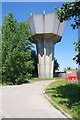
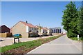
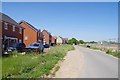
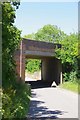
17 photos from this area
Area Information
Key information about the CM23 2GP including its size, population, and administrative classification.
- Area Type
- Postcode
- Area Size
- 7915 m²
- Population
- 2227
- Population Density
- 3455 people/km²
House Prices in CM23 2GP
23
Properties
£480,831
Average Sold Price
£281,250
Lowest Price
£660,000
Highest Price
Showing 23 properties
| Address | Type | Beds | Baths | Last Sale Price | Last Sale Date | |
|---|---|---|---|---|---|---|
| 1 Clark Street, Bishops Stortford, CM23 2GP | house | - | - | £550,000 | May 2022 | |
| 10 Clark Street, Bishops Stortford, CM23 2GP | house | - | - | £465,000 | Oct 2021 | |
| 14 Clark Street, Bishops Stortford, CM23 2GP | house | - | - | £499,995 | Jul 2021 | |
| 12 Clark Street, Bishops Stortford, CM23 2GP | Detached | 3 | - | £439,000 | Mar 2021 | |
| 18 Clark Street, Bishops Stortford, CM23 2GP | house | - | - | £281,250 | Dec 2019 | |
| 21 Clark Street, Bishops Stortford, CM23 2GP | house | - | - | £432,500 | Sep 2019 | |
| 19 Clark Street, Bishops Stortford, CM23 2GP | house | - | - | £422,500 | Aug 2019 | |
| 16 Clark Street, Bishops Stortford, CM23 2GP | house | - | - | £410,000 | Jun 2019 | |
| 17 Clark Street, Bishops Stortford, CM23 2GP | house | - | - | £535,000 | Mar 2019 | |
| 7 Clark Street, Bishops Stortford, CM23 2GP | house | 5 | - | £660,000 | Feb 2019 |
Page 1 of 3
Energy Efficiency in CM23 2GP
Amenities
Schools
| Rank | School | Type | Entry gender | Ages |
|---|
Explore more schools in this area
Go to Schools tabDemographics
Household Size
Family (3-5 people)
most common
Accommodation Type
Houses
most common
Tenure
82
majority
Ethnic Group
White
most common
Religion
N/A
most common
Household Composition
N/A
most common
Age
47
median
Adults (30-64 years)
most common
Household Deprivation
N/A
with no deprivation
NS-SEC
49
in Lower managerial occupations
Explore more demographic insights in this area
Go to Demographics tabPlanning
Planning Constraints
- Flood RiskPremium
- Ramsar Wetland SitesPremium
- Area of Outstanding Natural BeautyPremium
- Protected Nature ReservePremium
- Protected WoodlandPremium