Area Overview for CM23 1HD
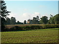
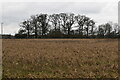
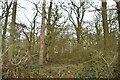
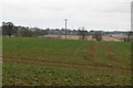
Photos of CM23 1HD

Area Information
CM23 1HD is a small residential cluster covering 32.9 hectares. The population stands at 1,612 people, resulting in a density of 62 people per square kilometre. This low density defines the character of the postcode, as living in CM23 1HD usually means you will encounter spacious surroundings rather than high-rise blocks or terraced rows. The area is situated in England, where the typical day involves navigating a quiet neighbourhood with minimal congestion. You will find that the layout supports a slower pace of life compared to denser urban centres. The postcode covers a specific pocket of housing that feels distinct from the broader localities around it. Residents here enjoy a setting that prioritises private space and access to the wider region without the pressures of crowded streets. The compact nature of the area means you are often close to local amenities, yet the overall footprint remains relatively small for a community of this size.
- Area Type
- Postcode
- Area Size
- 32.9 hectares
- Population
- 1612
- Population Density
- 62 people/km²
Homes in CM23 1HD are characterised by a specific accommodation type and ownership structure. Seventy-three per cent of the housing stock is owner-occupied, making this primarily a market for existing owners. The predominant accommodation type is Houses, meaning you will rarely encounter flats or purpose-built apartments within this postcode. This profile suggests that the available properties are likely detached or semi-detached dwellings designed for families or individuals seeking space. Living in CM23 1HD often means dealing with a more traditional inventory rather than new-build developments or modern blocks. The small size of the estate, covering just 32.9 hectares, limits the volume of properties on the market at any one time. Buyers here compete for a finite number of Houses, which can influence pricing dynamics. Because most residents own their homes, rental vacancies are uncommon in this specific cluster. Consequently, finding a property in CM23 1HD often requires searching for homes that have recently been put up for sale by owners looking to move.
House Prices in CM23 1HD
Showing 2 properties
| Address | Type | Beds | Baths | Last Sale Price | Last Sale Date | |
|---|---|---|---|---|---|---|
| Hazel Lodge, Hassobury, Farnham, CM23 1HD | Detached | - | - | - | - | |
| Manuden Lodge, Hassobury, Hazel End Lane, Farnham, CM23 1HD | Detached | - | - | - | - |
Energy Efficiency in CM23 1HD
Residents of CM23 1HD benefit from a practical range of amenities within easy reach. For groceries, you can visit Tesco Stansted, Co-op Stansted, or Morrisons Daily. These retail options ensure you have fresh food and daily essentials without needing to travel far. Transport links are well-served by five nearby railway stations, including Stansted Mountfitchet Railway Station, Bishops Stortford Railway Station, and Elsenham Railway Station. Commuting by train is quick and reliable from this location. Manchester is not mentioned in the data; instead, focus on the local stations provided. Stansted Mountfitchet Railway Station is particularly notable for its proximity. Additionally, London Stansted Airport is accessible to those needing air travel. One airport serves the region, providing direct flights to international destinations. Your lifestyle combines local convenience with national accessibility. Whether you need to pick up milk at Morrisons Daily or catch a train at Bishops Stortford Railway Station, the amenities are designed for efficiency. This mix of retail and transport hubs makes daily life in CM23 1HD straightforward and convenient.
Amenities
Schools
Families considering schools near CM23 1HD have access to several options with varying educational philosophies. Manuden Primary School is a Good rated primary institution, offering a state education foundation for younger children. Nearby is Farnham Church of England Primary School, which also holds a Good Ofsted rating. This indicates a high standard of provision for primary education within reasonable reach of the postcode. In addition to state schools, Waterside School is listed as an independent provider. This mix allows residents to choose between the structured environment of a state primary or the selective curriculum of an independent school. While specific Ofsted ratings for the independent option are not detailed in current records, its presence adds variety to local choices. Parents in CM23 1HD benefit from proximity to these three distinct institutions. You can enrol your child in either of the two rated primary schools or explore the independent sector nearby. This selection supports different educational priorities without requiring long commutes for daily schooling.
| Rank | School | Type | Entry gender | Ages |
|---|
Explore more schools in this area
Go to Schools tabDemographics
The community within CM23 1HD reflects a mature demographic profile. The median age is 47 years, indicating that Adults in the 30 to 64 years range form the most common age group. Nearly 73 per cent of residents own their homes, suggesting a settled population with long-term roots in the area. Households in CM23 1HD predominantly live in Houses rather than flats. This aligns with the home ownership percentage, which points to a market favouring family-sized or retirement properties. The predominant ethnic group is White, mirroring the broader trends often found in established residential clusters. With such a high rate of owner-occupation, the neighbourhood feels stable and community-focused. People here are likely to know their neighbours, as the low turnover associated with ownership fosters stronger local ties. This demographic mix creates an environment suitable for those seeking a quiet, established home away from the vibrancy of a rapidly changing city centre.
Household Size
Accommodation Type
Tenure
Ethnic Group
Religion
Household Composition
Age
Household Deprivation
NS-SEC
Explore more demographic insights in this area
Go to Demographics tabPlanning
Planning Constraints
- Flood RiskPremium
- Ramsar Wetland SitesPremium
- Area of Outstanding Natural BeautyPremium
- Protected Nature ReservePremium
- Protected WoodlandPremium