Area Overview for CM22 7UU
Photos of CM22 7UU
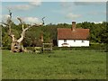
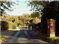
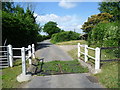
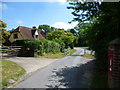
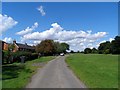
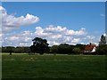
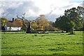
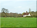
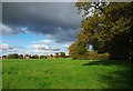
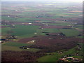
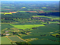
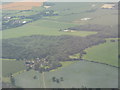
13 photos from this area
Area Information
Key information about the CM22 7UU including its size, population, and administrative classification.
- Area Type
- Postcode
- Area Size
- 58.4 hectares
- Population
- 2074
- Population Density
- 143 people/km²
House Prices in CM22 7UU
15
Properties
£448,929
Average Sold Price
£305,000
Lowest Price
£595,000
Highest Price
Showing 15 properties
| Address | Type | Beds | Baths | Last Sale Price | Last Sale Date | |
|---|---|---|---|---|---|---|
| Honeybee Barn, 76 Woodside Green, Great Hallingbury, CM22 7UU | house | - | - | £305,000 | Mar 2025 | |
| 71 Woodside Green, Great Hallingbury, CM22 7UU | house | - | - | £470,000 | Oct 2023 | |
| Bumblebee Cottage, 75 Woodside Green, Great Hallingbury, CM22 7UU | Terraced | 4 | 2 | £595,000 | Aug 2021 | |
| 73 Woodside Green, Great Hallingbury, CM22 7UU | Terraced | 3 | 1 | £400,000 | Aug 2021 | |
| 66 Woodside Green, Great Hallingbury, CM22 7UU | Semi-detached | 5 | 6 | £450,000 | Aug 2020 | |
| 72 Woodside Green, Great Hallingbury, CM22 7UU | Terraced | 3 | - | £357,500 | Sep 2015 | |
| Shoemakers, Woodside Green, Great Hallingbury, CM22 7UU | Detached | - | - | £565,000 | Jan 2008 | |
| 74 Woodside Green, Great Hallingbury, CM22 7UU | Semi-detached | 2 | 1 | - | - | |
| Old Thatched Cottage, Monksway, Woodside Green, Great Hallingbury, CM22 7UU | undefined | - | - | - | - | |
| Willow, Woodside Green, Great Hallingbury, CM22 7UU | undefined | - | - | - | - |
Page 1 of 2
Energy Efficiency in CM22 7UU
Amenities
Schools
| Rank | School | Type | Entry gender | Ages |
|---|
Explore more schools in this area
Go to Schools tabDemographics
Household Size
Family (3-5 people)
most common
Accommodation Type
Houses
most common
Tenure
79
majority
Ethnic Group
White
most common
Religion
N/A
most common
Household Composition
N/A
most common
Age
47
median
Adults (30-64 years)
most common
Household Deprivation
N/A
with no deprivation
NS-SEC
42
in Lower managerial occupations
Explore more demographic insights in this area
Go to Demographics tabPlanning
Planning Constraints
- Flood RiskPremium
- Ramsar Wetland SitesPremium
- Area of Outstanding Natural BeautyPremium
- Protected Nature ReservePremium
- Protected WoodlandPremium