Area Overview for CM22 7TL
Photos of CM22 7TL
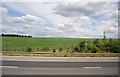
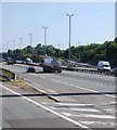
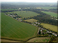
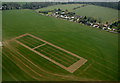
13 photos from this area
Area Information
Key information about the CM22 7TL including its size, population, and administrative classification.
- Area Type
- Postcode
- Area Size
- 67.6 hectares
- Population
- 1623
- Population Density
- 59 people/km²
House Prices in CM22 7TL
31
Properties
£561,389
Average Sold Price
£235,000
Lowest Price
£900,000
Highest Price
Showing 31 properties
| Address | Type | Beds | Baths | Last Sale Price | Last Sale Date | |
|---|---|---|---|---|---|---|
| Pennshurst, Bedlars Green, Bedlars Green, Great Hallingbury, CM22 7TL | Bungalow | 3 | 2 | £560,000 | Mar 2025 | |
| Cherry Trees, Bedlars Green, Bedlars Green, Great Hallingbury, CM22 7TL | Detached | 5 | - | £765,000 | Nov 2020 | |
| Leistbury, Bedlars Green, Bedlars Green, Great Hallingbury, CM22 7TL | Detached | 3 | 1 | £612,500 | Feb 2020 | |
| 153 Bedlars Green, Bedlars Green, Great Hallingbury, CM22 7TL | house | - | - | £460,000 | May 2018 | |
| East Lodge, Bedlars Green, Bedlars Green, Great Hallingbury, CM22 7TL | Detached | 4 | 2 | £900,000 | Oct 2017 | |
| Pryors Peace, Bedlars Green, Bedlars Green, Great Hallingbury, CM22 7TL | Detached | 3 | 1 | £515,000 | Jan 2016 | |
| Woodside Lodge, Bedlars Green, Bedlars Green, Great Hallingbury, CM22 7TL | Detached | 4 | 2 | £725,000 | Oct 2015 | |
| The Orchard, Bedlars Green, Bedlars Green, Great Hallingbury, CM22 7TL | Detached | 4 | - | £280,000 | Mar 2002 | |
| Bedlars Hall, Bedlars Green, Bedlars Green, Great Hallingbury, CM22 7TL | Land | 4 | 2 | £235,000 | Jul 1999 | |
| Golden Jubilee Cottage, Bedlars Green, Bedlars Green, Great Hallingbury, CM22 7TL | Detached | 4 | 3 | - | - |
Page 1 of 4
Energy Efficiency in CM22 7TL
Amenities
Schools
| Rank | School | Type | Entry gender | Ages |
|---|
Explore more schools in this area
Go to Schools tabDemographics
Household Size
Family (3-5 people)
most common
Accommodation Type
Houses
most common
Tenure
73
majority
Ethnic Group
White
most common
Religion
N/A
most common
Household Composition
N/A
most common
Age
47
median
Adults (30-64 years)
most common
Household Deprivation
N/A
with no deprivation
NS-SEC
41
in Lower managerial occupations
Explore more demographic insights in this area
Go to Demographics tabPlanning
Planning Constraints
- Flood RiskPremium
- Ramsar Wetland SitesPremium
- Area of Outstanding Natural BeautyPremium
- Protected Nature ReservePremium
- Protected WoodlandPremium