Area Overview for CM22 7RF
Photos of CM22 7RF

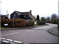


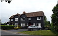
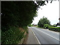


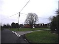
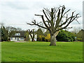


16 photos from this area
Area Information
Key information about the CM22 7RF including its size, population, and administrative classification.
- Area Type
- Postcode
- Area Size
- 5.2 hectares
- Population
- 2074
- Population Density
- 143 people/km²
House Prices in CM22 7RF
26
Properties
£629,751
Average Sold Price
£275,000
Lowest Price
£1,365,021
Highest Price
Showing 26 properties
| Address | Type | Beds | Baths | Last Sale Price | Last Sale Date | |
|---|---|---|---|---|---|---|
| Kernow, Wrights Green Lane, Little Hallingbury, CM22 7RF | Bungalow | 3 | 2 | £565,000 | Mar 2025 | |
| Casa Cyd, Wrights Green Lane, Little Hallingbury, CM22 7RF | Bungalow | 4 | 3 | £820,000 | Apr 2024 | |
| Wrights Green Cottage, Wrights Green Lane, Little Hallingbury, CM22 7RF | Retail | 2 | - | £565,000 | Jul 2022 | |
| Leah House, Wrights Green Lane, Little Hallingbury, CM22 7RF | Retail | 5 | - | £1,365,021 | Jun 2022 | |
| Wrights Lodge, Wrights Green, Little Hallingbury, CM22 7RF | Detached | 1 | 3 | £800,000 | Jun 2021 | |
| Bay Thorne, Wrights Green Lane, Little Hallingbury, CM22 7RF | Detached | 4 | 2 | £805,000 | Jul 2020 | |
| 1 Wrights Green Lane, Little Hallingbury, CM22 7RF | Detached | - | - | £685,000 | Jul 2019 | |
| Crispins, Wrights Green Lane, Little Hallingbury, CM22 7RF | Detached | 5 | - | £870,000 | Sep 2018 | |
| Greenways, Wrights Green Lane, Little Hallingbury, CM22 7RF | house | - | - | £591,000 | Dec 2016 | |
| Burrwood, Wrights Green Lane, Little Hallingbury, CM22 7RF | house | - | - | £490,000 | Jun 2011 |
Page 1 of 3
Energy Efficiency in CM22 7RF
Amenities
Schools
| Rank | School | Type | Entry gender | Ages |
|---|
Explore more schools in this area
Go to Schools tabDemographics
Household Size
Family (3-5 people)
most common
Accommodation Type
Houses
most common
Tenure
79
majority
Ethnic Group
White
most common
Religion
N/A
most common
Household Composition
N/A
most common
Age
47
median
Adults (30-64 years)
most common
Household Deprivation
N/A
with no deprivation
NS-SEC
42
in Lower managerial occupations
Explore more demographic insights in this area
Go to Demographics tabPlanning
Planning Constraints
- Flood RiskPremium
- Ramsar Wetland SitesPremium
- Area of Outstanding Natural BeautyPremium
- Protected Nature ReservePremium
- Protected WoodlandPremium