Area Overview for CM22 6QZ
Photos of CM22 6QZ
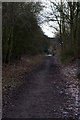
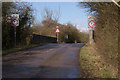
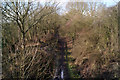
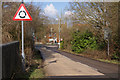
53 photos from this area
Area Information
Key information about the CM22 6QZ including its size, population, and administrative classification.
- Area Type
- Postcode
- Area Size
- 2.2 hectares
- Population
- Not available
- Population Density
- Not available
House Prices in CM22 6QZ
46
Properties
£316,079
Average Sold Price
£77,000
Lowest Price
£495,000
Highest Price
Showing 46 properties
| Address | Type | Beds | Baths | Last Sale Price | Last Sale Date | |
|---|---|---|---|---|---|---|
| 61 Roseacres, Takeley, CM22 6QZ | Semi-detached | 4 | 1 | £410,000 | Dec 2024 | |
| 51 Roseacres, Takeley, CM22 6QZ | Semi-detached | 3 | 1 | £423,000 | Aug 2023 | |
| 48 Roseacres, Takeley, CM22 6QZ | Detached | 3 | 2 | £495,000 | Jan 2023 | |
| 35 Roseacres, Takeley, CM22 6QZ | Semi-detached | 2 | 1 | £425,000 | Jan 2023 | |
| 63 Roseacres, Takeley, CM22 6QZ | Semi-detached | 3 | 1 | £425,000 | Apr 2022 | |
| 62 Roseacres, Takeley, CM22 6QZ | house | - | - | £435,000 | Feb 2022 | |
| 25 Roseacres, Takeley, CM22 6QZ | Semi-detached | 3 | 2 | £425,000 | Feb 2022 | |
| 28 Roseacres, Takeley, CM22 6QZ | house | - | - | £427,500 | Dec 2021 | |
| 39 Roseacres, Takeley, CM22 6QZ | Detached | 3 | - | £475,000 | May 2021 | |
| 43 Roseacres, Takeley, CM22 6QZ | Semi-detached | 2 | - | £306,000 | Sep 2019 |
Page 1 of 5
Energy Efficiency in CM22 6QZ
Amenities
Schools
| Rank | School | Type | Entry gender | Ages |
|---|
Explore more schools in this area
Go to Schools tabDemographics
Household Size
Family (3-5 people)
most common
Accommodation Type
Houses
most common
Tenure
73
majority
Ethnic Group
White
most common
Religion
N/A
most common
Household Composition
N/A
most common
Age
47
median
Adults (30-64 years)
most common
Household Deprivation
N/A
with no deprivation
NS-SEC
38
in Lower managerial occupations
Explore more demographic insights in this area
Go to Demographics tabPlanning
Planning Constraints
- Flood RiskPremium
- Ramsar Wetland SitesPremium
- Area of Outstanding Natural BeautyPremium
- Protected Nature ReservePremium
- Protected WoodlandPremium