Area Overview for CM22 6QR
Photos of CM22 6QR
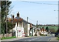
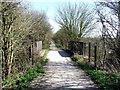
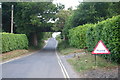
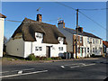
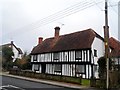

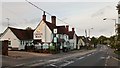
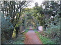
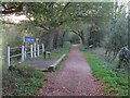
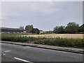

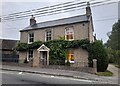
31 photos from this area
Area Information
Key information about the CM22 6QR including its size, population, and administrative classification.
- Area Type
- Postcode
- Area Size
- 9.2 hectares
- Population
- 1914
- Population Density
- 158 people/km²
House Prices in CM22 6QR
28
Properties
£391,219
Average Sold Price
£170,000
Lowest Price
£625,000
Highest Price
Showing 28 properties
| Address | Type | Beds | Baths | Last Sale Price | Last Sale Date | |
|---|---|---|---|---|---|---|
| 1, Pipers, The Street, Takeley, CM22 6QR | Detached | 4 | - | £442,500 | Nov 2023 | |
| 2, Pipers, The Street, Takeley, CM22 6QR | Semi-detached | 4 | 3 | £420,000 | Jul 2023 | |
| 2, Mill Cottage, The Street, Takeley, CM22 6QR | house | - | - | £450,000 | Jan 2022 | |
| Ramor, The Street, Takeley, CM22 6QR | Bungalow | - | - | £417,000 | Sep 2021 | |
| Glenmore, The Street, Takeley, CM22 6QR | house | - | - | £420,000 | Sep 2021 | |
| Shielars Cottage, 120 The Street, Takeley, CM22 6QR | Retail | 3 | 3 | £445,000 | Jun 2021 | |
| MILL HOUSE, THE STREET, Takeley, CM22 6QR | Detached | 6 | 4 | £625,000 | May 2019 | |
| Old Bakery, The Street, Takeley, CM22 6QR | Semi-detached | 4 | 2 | £475,000 | May 2019 | |
| Gable Cottage, The Street, Takeley, CM22 6QR | Semi-detached | 2 | - | £295,000 | Nov 2016 | |
| Romany House, Dunmow Road, Takeley, CM22 6QR | Detached | 5 | - | £550,000 | Jun 2015 |
Page 1 of 3
Energy Efficiency in CM22 6QR
Amenities
Schools
| Rank | School | Type | Entry gender | Ages |
|---|
Explore more schools in this area
Go to Schools tabDemographics
Household Size
Family (3-5 people)
most common
Accommodation Type
Houses
most common
Tenure
66
majority
Ethnic Group
White
most common
Religion
N/A
most common
Household Composition
N/A
most common
Age
47
median
Adults (30-64 years)
most common
Household Deprivation
N/A
with no deprivation
NS-SEC
36
in Lower managerial occupations
Explore more demographic insights in this area
Go to Demographics tabPlanning
Planning Constraints
- Flood RiskPremium
- Ramsar Wetland SitesPremium
- Area of Outstanding Natural BeautyPremium
- Protected Nature ReservePremium
- Protected WoodlandPremium