Area Overview for CM22 6PU
Photos of CM22 6PU
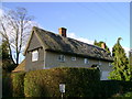


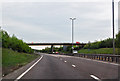


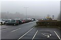
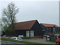


21 photos from this area
Area Information
Key information about the CM22 6PU including its size, population, and administrative classification.
- Area Type
- Postcode
- Area Size
- 57.4 hectares
- Population
- 1914
- Population Density
- 158 people/km²
House Prices in CM22 6PU
56
Properties
£373,660
Average Sold Price
£190,000
Lowest Price
£514,800
Highest Price
Showing 56 properties
| Address | Type | Beds | Baths | Last Sale Price | Last Sale Date | |
|---|---|---|---|---|---|---|
| Lynton, Parsonage Road, Takeley, CM22 6PU | Bungalow | 5 | - | £413,500 | Dec 2024 | |
| Fairview, Parsonage Road, Takeley, CM22 6PU | Bungalow | 2 | 1 | £370,000 | Aug 2023 | |
| 6, Old House Villas, Parsonage Road, Takeley, CM22 6PU | Semi-detached | 3 | - | £380,000 | Sep 2022 | |
| 2, Old House Villas, Parsonage Road, Takeley, CM22 6PU | Detached | 3 | - | £190,000 | Aug 2011 | |
| Easton, Parsonage Road, Takeley, CM22 6PU | house | 4 | 2 | £514,800 | Feb 2009 | |
| Formerly Known As The Old House, Parsonage Road, Takeley, CM22 6PU | Semi-detached | - | - | - | - | |
| Old Farm House, Parsonage Road, Takeley, CM22 6PU | Detached | - | - | - | - | |
| Suite D Ground Floor, Skyways House, Parsonage Road, Takeley, CM22 6PU | Office | - | - | - | - | |
| Synthetix Limited, Unit 6, Stansted Courtyard, Parsonage Road, Takeley, CM22 6PU | office_workshop | - | - | - | - | |
| Suite 4, Skyways House, Parsonage Road, Takeley, CM22 6PU | Office | - | - | - | - |
Page 1 of 6
Energy Efficiency in CM22 6PU
Amenities
Schools
| Rank | School | Type | Entry gender | Ages |
|---|
Explore more schools in this area
Go to Schools tabDemographics
Household Size
Family (3-5 people)
most common
Accommodation Type
Houses
most common
Tenure
66
majority
Ethnic Group
White
most common
Religion
N/A
most common
Household Composition
N/A
most common
Age
47
median
Adults (30-64 years)
most common
Household Deprivation
N/A
with no deprivation
NS-SEC
36
in Lower managerial occupations
Explore more demographic insights in this area
Go to Demographics tabPlanning
Planning Constraints
- Flood RiskPremium
- Ramsar Wetland SitesPremium
- Area of Outstanding Natural BeautyPremium
- Protected Nature ReservePremium
- Protected WoodlandPremium