Area Overview for CM22 6HR
Photos of CM22 6HR
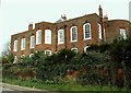
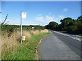
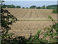
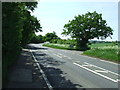
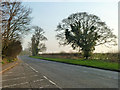
10 photos from this area
Area Information
Key information about the CM22 6HR including its size, population, and administrative classification.
- Area Type
- Postcode
- Area Size
- 27.1 hectares
- Population
- 1796
- Population Density
- 161 people/km²
House Prices in CM22 6HR
12
Properties
£419,750
Average Sold Price
£250,000
Lowest Price
£875,000
Highest Price
Showing 12 properties
| Address | Type | Beds | Baths | Last Sale Price | Last Sale Date | |
|---|---|---|---|---|---|---|
| The Old Post House, Cambridge Road, Ugley, CM22 6HR | Detached | 4 | 3 | £875,000 | Oct 2023 | |
| 6, The Square, Cambridge Road, Ugley, CM22 6HR | Semi-detached | - | - | £390,000 | Feb 2018 | |
| 7, The Square, Cambridge Road, Ugley, CM22 6HR | house | - | - | £300,000 | Jan 2011 | |
| 5, The Square, Cambridge Road, Ugley, CM22 6HR | Detached | - | - | £250,000 | Apr 2008 | |
| Stoney Close, Cambridge Road, Ugley, CM22 6HR | Detached | 1 | - | £283,750 | Mar 2005 | |
| Old Post House, The Square, Cambridge Road, Ugley, CM22 6HR | undefined | - | - | - | - | |
| Ugley Village Hall, Cambridge Road, Ugley, CM22 6HR | commercial | - | - | - | - | |
| Montefiore House, Cambridge Road, Ugley, CM22 6HR | Detached | - | - | - | - | |
| The Patricia Lawrence Room, Ugley Village Hall, Cambridge Road, Ugley, CM22 6HR | commercial | - | - | - | - | |
| The White Hart, Cambridge Road, Ugley, CM22 6HR | Detached | - | - | - | - |
Page 1 of 2
Energy Efficiency in CM22 6HR
Amenities
Schools
| Rank | School | Type | Entry gender | Ages |
|---|
Explore more schools in this area
Go to Schools tabDemographics
Household Size
Two person
most common
Accommodation Type
Houses
most common
Tenure
77
majority
Ethnic Group
White
most common
Religion
N/A
most common
Household Composition
N/A
most common
Age
47
median
Adults (30-64 years)
most common
Household Deprivation
N/A
with no deprivation
NS-SEC
42
in Lower managerial occupations
Explore more demographic insights in this area
Go to Demographics tabPlanning
Planning Constraints
- Flood RiskPremium
- Ramsar Wetland SitesPremium
- Area of Outstanding Natural BeautyPremium
- Protected Nature ReservePremium
- Protected WoodlandPremium