Area Overview for CM22 6DS
Photos of CM22 6DS

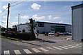


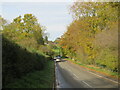
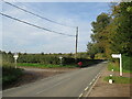


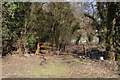
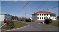

12 photos from this area
Area Information
Key information about the CM22 6DS including its size, population, and administrative classification.
- Area Type
- Postcode
- Area Size
- 60.6 hectares
- Population
- 2482
- Population Density
- 111 people/km²
House Prices in CM22 6DS
17
Properties
£406,667
Average Sold Price
£175,000
Lowest Price
£620,000
Highest Price
Showing 17 properties
| Address | Type | Beds | Baths | Last Sale Price | Last Sale Date | |
|---|---|---|---|---|---|---|
| Magnolia Cottage, Green Street, Elsenham, CM22 6DS | Semi-detached | 3 | 2 | £425,000 | May 2025 | |
| Motts Hall, Green Street, Elsenham, CM22 6DS | Detached | 5 | 2 | £620,000 | Jun 2018 | |
| Blue Pines, Green Street, Elsenham, CM22 6DS | Semi-detached | - | - | £175,000 | Jun 2001 | |
| 3, Sumach Cottage, Gaunts End Cottages, Green Street, Elsenham, CM22 6DS | Semi-detached | 3 | 1 | - | - | |
| Tumbleweed Cottage, Green Street, Elsenham, CM22 6DS | Detached | - | - | - | - | |
| The Clock House, Green Street, Elsenham, CM22 6DS | Detached | - | - | - | - | |
| 3 Green Street, Elsenham, CM22 6DS | undefined | - | - | - | - | |
| Hytek Gb Ltd, Delta House, Green Street, Elsenham, CM22 6DS | Industrial | - | - | - | - | |
| Orchard Barn, Gaunts End, Green Street, Elsenham, CM22 6DS | Detached | - | - | - | - | |
| Goldwell And K M S California, Molton Brown Cosmetics, Green Street, Elsenham, CM22 6DS | warehouse | - | - | - | - |
Page 1 of 2
Energy Efficiency in CM22 6DS
Amenities
Schools
| Rank | School | Type | Entry gender | Ages |
|---|
Explore more schools in this area
Go to Schools tabDemographics
Household Size
Family (3-5 people)
most common
Accommodation Type
Houses
most common
Tenure
85
majority
Ethnic Group
White
most common
Religion
N/A
most common
Household Composition
N/A
most common
Age
47
median
Adults (30-64 years)
most common
Household Deprivation
N/A
with no deprivation
NS-SEC
46
in Lower managerial occupations
Explore more demographic insights in this area
Go to Demographics tabPlanning
Planning Constraints
- Flood RiskPremium
- Ramsar Wetland SitesPremium
- Area of Outstanding Natural BeautyPremium
- Protected Nature ReservePremium
- Protected WoodlandPremium