Area Overview for CM21 9EY
Photos of CM21 9EY
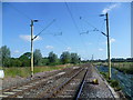
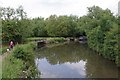
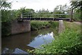
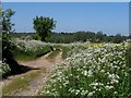
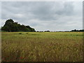
27 photos from this area
Area Information
Key information about the CM21 9EY including its size, population, and administrative classification.
- Area Type
- Postcode
- Area Size
- 42.7 hectares
- Population
- 1591
- Population Density
- 2546 people/km²
House Prices in CM21 9EY
23
Properties
£419,379
Average Sold Price
£160,000
Lowest Price
£790,000
Highest Price
Showing 23 properties
| Address | Type | Beds | Baths | Last Sale Price | Last Sale Date | |
|---|---|---|---|---|---|---|
| 6 Kingsmead, Sawbridgeworth, CM21 9EY | Bungalow | 2 | 2 | £635,000 | Jan 2025 | |
| 7 Kingsmead, Sawbridgeworth, CM21 9EY | Bungalow | 2 | - | £560,000 | Jun 2021 | |
| 19 Kingsmead, Sawbridgeworth, CM21 9EY | Detached | 4 | 1 | £637,500 | May 2021 | |
| 9 Kingsmead, Sawbridgeworth, CM21 9EY | Detached | 4 | - | £497,950 | Jun 2020 | |
| 16 Kingsmead, Sawbridgeworth, CM21 9EY | Detached | 5 | 2 | £790,000 | Oct 2019 | |
| Noble Prospect, 13 Kingsmead, Sawbridgeworth, CM21 9EY | Bungalow | 3 | 2 | £530,000 | Nov 2015 | |
| 12 Kingsmead, Sawbridgeworth, CM21 9EY | Bungalow | 2 | - | £390,000 | Aug 2014 | |
| 8 Kingsmead, Sawbridgeworth, CM21 9EY | house | 3 | - | £345,000 | Mar 2013 | |
| 21 Kingsmead, Sawbridgeworth, CM21 9EY | house | - | - | £430,000 | Jun 2010 | |
| 1 Kingsmead, Sawbridgeworth, CM21 9EY | Bungalow | 3 | 1 | £249,000 | Apr 2007 |
Page 1 of 3
Energy Efficiency in CM21 9EY
Amenities
Schools
| Rank | School | Type | Entry gender | Ages |
|---|
Explore more schools in this area
Go to Schools tabDemographics
Household Size
Family (3-5 people)
most common
Accommodation Type
Houses
most common
Tenure
88
majority
Ethnic Group
White
most common
Religion
N/A
most common
Household Composition
N/A
most common
Age
47
median
Adults (30-64 years)
most common
Household Deprivation
N/A
with no deprivation
NS-SEC
47
in Lower managerial occupations
Explore more demographic insights in this area
Go to Demographics tabPlanning
Planning Constraints
- Flood RiskPremium
- Ramsar Wetland SitesPremium
- Area of Outstanding Natural BeautyPremium
- Protected Nature ReservePremium
- Protected WoodlandPremium