Area Overview for CM21 0LS
Photos of CM21 0LS
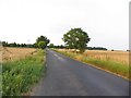
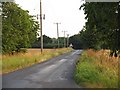
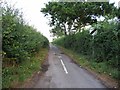
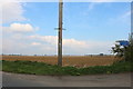

10 photos from this area
Area Information
Key information about the CM21 0LS including its size, population, and administrative classification.
- Area Type
- Postcode
- Area Size
- 13.6 hectares
- Population
- 1416
- Population Density
- 60 people/km²
House Prices in CM21 0LS
10
Properties
£453,714
Average Sold Price
£250,000
Lowest Price
£625,000
Highest Price
Showing 10 properties
| Address | Type | Beds | Baths | Last Sale Price | Last Sale Date | |
|---|---|---|---|---|---|---|
| Fir Tree Cottage, Blounts Lane, Allens Green, CM21 0LS | Semi-detached | 3 | - | £611,000 | Sep 2024 | |
| Rose Cottage, Blounts Lane, Allens Green, CM21 0LS | Detached | 4 | - | £525,000 | Apr 2010 | |
| Leaky Cauldron Corner, Blounts Lane, Allens Green, CM21 0LS | Detached | 5 | - | £625,000 | Sep 2009 | |
| Pond Cottage, Blounts Lane, Allens Green, CM21 0LS | Bungalow | 3 | 1 | £480,000 | Sep 2005 | |
| Shingle Cottage, Blounts Lane, Allens Green, CM21 0LS | Cottage | 3 | - | £250,000 | Jul 2004 | |
| Bluebell Cottage, Blounts Lane, Allens Green, CM21 0LS | Semi-detached | 4 | 3 | £345,000 | Jul 2003 | |
| Ivy Cottage, Blounts Lane, Allens Green, CM21 0LS | Detached | - | - | £340,000 | Oct 1998 | |
| The Flat, The Queens Head, Blounts Lane, Allens Green, CM21 0LS | Flat | - | - | - | - | |
| Ventham Court, Blounts Lane, Allens Green, CM21 0LS | Detached | - | - | - | - | |
| Longlands, Blounts Lane, Allens Green, CM21 0LS | Detached | - | - | - | - |
Energy Efficiency in CM21 0LS
Amenities
Schools
| Rank | School | Type | Entry gender | Ages |
|---|
Explore more schools in this area
Go to Schools tabDemographics
Household Size
Family (3-5 people)
most common
Accommodation Type
Houses
most common
Tenure
67
majority
Ethnic Group
White
most common
Religion
N/A
most common
Household Composition
N/A
most common
Age
47
median
Adults (30-64 years)
most common
Household Deprivation
N/A
with no deprivation
NS-SEC
37
in Lower managerial occupations
Explore more demographic insights in this area
Go to Demographics tabPlanning
Planning Constraints
- Flood RiskPremium
- Ramsar Wetland SitesPremium
- Area of Outstanding Natural BeautyPremium
- Protected Nature ReservePremium
- Protected WoodlandPremium