Area Overview for CM21 0HN
Photos of CM21 0HN
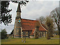
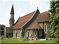
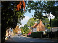
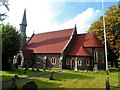
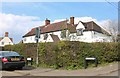
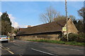
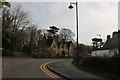
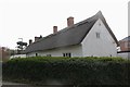
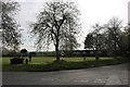
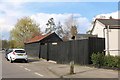
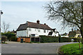
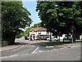
12 photos from this area
Area Information
Key information about the CM21 0HN including its size, population, and administrative classification.
- Area Type
- Postcode
- Area Size
- 15.6 hectares
- Population
- 1667
- Population Density
- 449 people/km²
House Prices in CM21 0HN
47
Properties
£298,056
Average Sold Price
£97,000
Lowest Price
£440,000
Highest Price
Showing 47 properties
| Address | Type | Beds | Baths | Last Sale Price | Last Sale Date | |
|---|---|---|---|---|---|---|
| 58 Mabeys Walk, High Wych, CM21 0HN | Semi-detached | 3 | - | £425,000 | Mar 2021 | |
| 21 Mabeys Walk, High Wych, CM21 0HN | Semi-detached | 3 | 1 | £385,000 | Nov 2018 | |
| 17 Mabeys Walk, High Wych, CM21 0HN | house | 3 | 1 | £440,000 | Jan 2018 | |
| 38 Mabeys Walk, High Wych, CM21 0HN | Terraced | 3 | 1 | £325,500 | Sep 2016 | |
| 62 Mabeys Walk, High Wych, CM21 0HN | Semi-detached | 3 | - | £320,000 | Dec 2015 | |
| 54 Mabeys Walk, High Wych, CM21 0HN | Detached | 3 | 1 | £322,000 | Jun 2014 | |
| 60 Mabeys Walk, High Wych, CM21 0HN | Semi-detached | - | - | £239,000 | Aug 2006 | |
| 36 Mabeys Walk, High Wych, CM21 0HN | Terraced | - | - | £97,000 | Dec 1999 | |
| 52 Mabeys Walk, High Wych, CM21 0HN | Semi-detached | - | - | £129,000 | Sep 1999 | |
| 40 Mabeys Walk, High Wych, CM21 0HN | Terraced | 3 | 1 | - | - |
Page 1 of 5
Energy Efficiency in CM21 0HN
Amenities
Schools
| Rank | School | Type | Entry gender | Ages |
|---|
Explore more schools in this area
Go to Schools tabDemographics
Household Size
Two person
most common
Accommodation Type
Houses
most common
Tenure
95
majority
Ethnic Group
White
most common
Religion
N/A
most common
Household Composition
N/A
most common
Age
47
median
Adults (30-64 years)
most common
Household Deprivation
N/A
with no deprivation
NS-SEC
46
in Lower managerial occupations
Explore more demographic insights in this area
Go to Demographics tabPlanning
Planning Constraints
- Flood RiskPremium
- Ramsar Wetland SitesPremium
- Area of Outstanding Natural BeautyPremium
- Protected Nature ReservePremium
- Protected WoodlandPremium