Area Overview for CM2 9RX
Photos of CM2 9RX
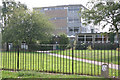
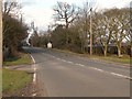

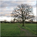
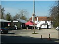
9 photos from this area
Area Information
Key information about the CM2 9RX including its size, population, and administrative classification.
- Area Type
- Postcode
- Area Size
- 1.0 hectares
- Population
- 1538
- Population Density
- 1881 people/km²
House Prices in CM2 9RX
12
Properties
£415,389
Average Sold Price
£34,000
Lowest Price
£795,000
Highest Price
Showing 12 properties
| Address | Type | Beds | Baths | Last Sale Price | Last Sale Date | |
|---|---|---|---|---|---|---|
| 82 Beehive Lane, Great Baddow, Chelmsford, CM2 9RX | Semi-detached | 3 | 1 | £407,000 | Sep 2024 | |
| 84 Beehive Lane, Great Baddow, Chelmsford, CM2 9RX | Retail | 3 | 2 | £420,000 | Oct 2022 | |
| 68 Beehive Lane, Great Baddow, Chelmsford, CM2 9RX | house | - | - | £772,500 | Sep 2021 | |
| 64 Beehive Lane, Great Baddow, Chelmsford, CM2 9RX | house | - | - | £795,000 | Jun 2021 | |
| 76 Beehive Lane, Great Baddow, Chelmsford, CM2 9RX | Semi-detached | 4 | - | £310,000 | Sep 2014 | |
| 135 Beehive Lane, Great Baddow, Chelmsford, CM2 9RX | house | 4 | - | £600,000 | Aug 2012 | |
| 80 Beehive Lane, Great Baddow, Chelmsford, CM2 9RX | Semi-detached | 3 | - | £120,000 | Aug 2002 | |
| 66 Beehive Lane, Great Baddow, Chelmsford, CM2 9RX | Detached | - | - | £280,000 | Sep 2000 | |
| 74 Beehive Lane, Great Baddow, Chelmsford, CM2 9RX | Semi-detached | - | - | £34,000 | Feb 1997 | |
| 72 Beehive Lane, Great Baddow, Chelmsford, CM2 9RX | house | - | - | - | - |
Page 1 of 2
Energy Efficiency in CM2 9RX
Amenities
Schools
| Rank | School | Type | Entry gender | Ages |
|---|
Explore more schools in this area
Go to Schools tabDemographics
Household Size
Family (3-5 people)
most common
Accommodation Type
Houses
most common
Tenure
71
majority
Ethnic Group
White
most common
Religion
N/A
most common
Household Composition
N/A
most common
Age
47
median
Adults (30-64 years)
most common
Household Deprivation
N/A
with no deprivation
NS-SEC
37
in Lower managerial occupations
Explore more demographic insights in this area
Go to Demographics tabPlanning
Planning Constraints
- Flood RiskPremium
- Ramsar Wetland SitesPremium
- Area of Outstanding Natural BeautyPremium
- Protected Nature ReservePremium
- Protected WoodlandPremium