Area Overview for CM2 8UN
Photos of CM2 8UN
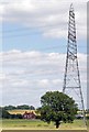
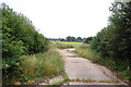
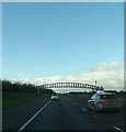
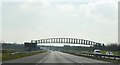

20 photos from this area
Area Information
Key information about the CM2 8UN including its size, population, and administrative classification.
- Area Type
- Postcode
- Area Size
- 1.2 km²
- Population
- 1495
- Population Density
- 133 people/km²
House Prices in CM2 8UN
13
Properties
£254,313
Average Sold Price
£92,000
Lowest Price
£560,000
Highest Price
Showing 13 properties
| Address | Type | Beds | Baths | Last Sale Price | Last Sale Date | |
|---|---|---|---|---|---|---|
| Hawthorns, Church Road, West Hanningfield, Chelmsford, CM2 8UN | house | - | - | £560,000 | Jul 2016 | |
| 1, Agricultural Cottages, Church Road, West Hanningfield, Chelmsford, CM2 8UN | house | 3 | - | £272,500 | Apr 2012 | |
| Drummers Cottage, Church Road, West Hanningfield, Chelmsford, CM2 8UN | Semi-detached | - | - | £92,000 | Aug 1996 | |
| Hophedges, Church Road, West Hanningfield, Chelmsford, CM2 8UN | Detached | - | - | £92,750 | Jun 1995 | |
| 2, Agricultural Cottages, Church Road, West Hanningfield, Chelmsford, CM2 8UN | Semi-detached | 3 | 1 | - | - | |
| 3, Agricultural Cottages, Church Road, West Hanningfield, Chelmsford, CM2 8UN | Retail | 3 | 2 | - | - | |
| Chelsworth, Church Road, West Hanningfield, Chelmsford, CM2 8UN | Bungalow | - | - | - | - | |
| 4, Agricultural Cottages, Church Road, West Hanningfield, Chelmsford, CM2 8UN | Semi-detached | - | - | - | - | |
| Field Edge, Church Road, West Hanningfield, Chelmsford, CM2 8UN | house | 3 | 1 | - | - | |
| Link House Farm, Church Road, West Hanningfield, Chelmsford, CM2 8UN | Detached | - | - | - | - |
Page 1 of 2
Energy Efficiency in CM2 8UN
Amenities
Schools
| Rank | School | Type | Entry gender | Ages |
|---|
Explore more schools in this area
Go to Schools tabDemographics
Household Size
One person
most common
Accommodation Type
Houses
most common
Tenure
86
majority
Ethnic Group
White
most common
Religion
N/A
most common
Household Composition
N/A
most common
Age
47
median
Adults (30-64 years)
most common
Household Deprivation
N/A
with no deprivation
NS-SEC
42
in Lower managerial occupations
Explore more demographic insights in this area
Go to Demographics tabPlanning
Planning Constraints
- Flood RiskPremium
- Ramsar Wetland SitesPremium
- Area of Outstanding Natural BeautyPremium
- Protected Nature ReservePremium
- Protected WoodlandPremium