Area Overview for CM2 7TJ
Photos of CM2 7TJ
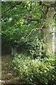
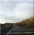

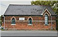
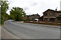
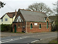

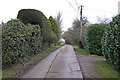
18 photos from this area
Area Information
Key information about the CM2 7TJ including its size, population, and administrative classification.
- Area Type
- Postcode
- Area Size
- 1.4 hectares
- Population
- 1535
- Population Density
- 146 people/km²
House Prices in CM2 7TJ
10
Properties
£657,000
Average Sold Price
£425,000
Lowest Price
£975,000
Highest Price
Showing 10 properties
| Address | Type | Beds | Baths | Last Sale Price | Last Sale Date | |
|---|---|---|---|---|---|---|
| All Bryn, East Hanningfield Road, Sandon, Chelmsford, CM2 7TJ | Bungalow | 3 | 2 | £600,000 | Sep 2024 | |
| 5 East Hanningfield Road, Sandon, Chelmsford, CM2 7TJ | Detached | 4 | 3 | £845,000 | May 2024 | |
| Paigles, East Hanningfield Road, Sandon, Chelmsford, CM2 7TJ | Detached | 4 | - | £975,000 | Oct 2018 | |
| 1 East Hanningfield Road, Sandon, Chelmsford, CM2 7TJ | Detached | 5 | 4 | £440,000 | Nov 2006 | |
| Charnwood, East Hanningfield Road, Sandon, Chelmsford, CM2 7TJ | Detached | - | - | £425,000 | Sep 2005 | |
| 7 East Hanningfield Road, Sandon, Chelmsford, CM2 7TJ | Detached | - | - | - | - | |
| 3 East Hanningfield Road, Sandon, Chelmsford, CM2 7TJ | Detached | - | - | - | - | |
| Oaklands, East Hanningfield Road, Sandon, Chelmsford, CM2 7TJ | Detached | - | - | - | - | |
| Rhumsaa, East Hanningfield Road, Sandon, Chelmsford, CM2 7TJ | Detached | - | - | - | - | |
| Greensleeves, East Hanningfield Road, Sandon, Chelmsford, CM2 7TJ | Detached | - | - | - | - |
Energy Efficiency in CM2 7TJ
Amenities
Schools
| Rank | School | Type | Entry gender | Ages |
|---|
Explore more schools in this area
Go to Schools tabDemographics
Household Size
Family (3-5 people)
most common
Accommodation Type
Houses
most common
Tenure
84
majority
Ethnic Group
White
most common
Religion
N/A
most common
Household Composition
N/A
most common
Age
47
median
Adults (30-64 years)
most common
Household Deprivation
N/A
with no deprivation
NS-SEC
45
in Lower managerial occupations
Explore more demographic insights in this area
Go to Demographics tabPlanning
Planning Constraints
- Flood RiskPremium
- Ramsar Wetland SitesPremium
- Area of Outstanding Natural BeautyPremium
- Protected Nature ReservePremium
- Protected WoodlandPremium