Area Overview for CM2 7TB
Photos of CM2 7TB
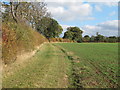
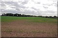
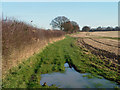
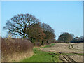
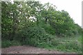
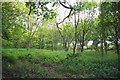
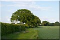
8 photos from this area
Area Information
Key information about the CM2 7TB including its size, population, and administrative classification.
- Area Type
- Postcode
- Area Size
- 91.0 hectares
- Population
- 1535
- Population Density
- 146 people/km²
House Prices in CM2 7TB
13
Properties
£297,500
Average Sold Price
£290,000
Lowest Price
£305,000
Highest Price
Showing 13 properties
| Address | Type | Beds | Baths | Last Sale Price | Last Sale Date | |
|---|---|---|---|---|---|---|
| The Paddocks, Old Southend Road, Sandon, Chelmsford, CM2 7TB | Bungalow | 2 | - | £305,000 | Feb 2013 | |
| 1, Little Claydons Cottages, Old Southend Road, Sandon, Chelmsford, CM2 7TB | Semi-detached | - | - | £290,000 | Apr 2012 | |
| Claydon Clinic, Little Claydons, Old Southend Road, Sandon, Chelmsford, CM2 7TB | commercial | - | - | - | - | |
| Outbuilding, Rowlands, Old Southend Road, Sandon, Chelmsford, CM2 7TB | commercial | - | - | - | - | |
| Rowlands, Old Southend Road, Sandon, Chelmsford, CM2 7TB | Detached | - | - | - | - | |
| Tall Trees, Old Southend Road, Sandon, Chelmsford, CM2 7TB | Detached | - | - | - | - | |
| Former Rowlands, Old Southend Road, Sandon, Chelmsford, CM2 7TB | undefined | - | - | - | - | |
| Former Caravan Little Claydons, Old Southend Road, Sandon, Chelmsford, CM2 7TB | Mobile Home | - | - | - | - | |
| Former Little Claydons Bungalow, Old Southend Road, Sandon, Chelmsford, CM2 7TB | undefined | - | - | - | - | |
| Agricultural Building At, Little Claydons Farm, Old Southend Road, Sandon, Chelmsford, CM2 7TB | office_workshop | - | - | - | - |
Page 1 of 2
Energy Efficiency in CM2 7TB
Amenities
Schools
| Rank | School | Type | Entry gender | Ages |
|---|
Explore more schools in this area
Go to Schools tabDemographics
Household Size
Family (3-5 people)
most common
Accommodation Type
Houses
most common
Tenure
84
majority
Ethnic Group
White
most common
Religion
N/A
most common
Household Composition
N/A
most common
Age
47
median
Adults (30-64 years)
most common
Household Deprivation
N/A
with no deprivation
NS-SEC
45
in Lower managerial occupations
Explore more demographic insights in this area
Go to Demographics tabPlanning
Planning Constraints
- Flood RiskPremium
- Ramsar Wetland SitesPremium
- Area of Outstanding Natural BeautyPremium
- Protected Nature ReservePremium
- Protected WoodlandPremium