Area Overview for CM2 7AR
Photos of CM2 7AR

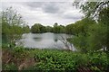
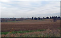

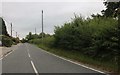
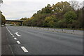

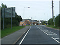
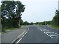

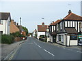

17 photos from this area
Area Information
Key information about the CM2 7AR including its size, population, and administrative classification.
- Area Type
- Postcode
- Area Size
- 4115 m²
- Population
- 1839
- Population Density
- 1262 people/km²
House Prices in CM2 7AR
13
Properties
£285,255
Average Sold Price
£178,000
Lowest Price
£460,050
Highest Price
Showing 13 properties
| Address | Type | Beds | Baths | Last Sale Price | Last Sale Date | |
|---|---|---|---|---|---|---|
| 10 Stuart Close, Great Baddow, Chelmsford, CM2 7AR | house | 3 | 1 | £450,000 | Mar 2025 | |
| 11 Stuart Close, Great Baddow, Chelmsford, CM2 7AR | Semi-detached | 3 | 1 | £460,050 | Feb 2023 | |
| 4 Stuart Close, Great Baddow, Chelmsford, CM2 7AR | house | - | - | £330,000 | Apr 2021 | |
| 13 Stuart Close, Great Baddow, Chelmsford, CM2 7AR | Semi-detached | 3 | 1 | £348,000 | Oct 2017 | |
| 6 Stuart Close, Great Baddow, Chelmsford, CM2 7AR | Semi-detached | 3 | - | £225,000 | Aug 2013 | |
| 3 Stuart Close, Great Baddow, Chelmsford, CM2 7AR | house | - | - | £210,000 | Jul 2010 | |
| 7 Stuart Close, Great Baddow, Chelmsford, CM2 7AR | Semi-detached | 3 | - | £242,500 | Apr 2008 | |
| 5 Stuart Close, Great Baddow, Chelmsford, CM2 7AR | Semi-detached | - | - | £223,000 | Dec 2007 | |
| 2 Stuart Close, Great Baddow, Chelmsford, CM2 7AR | Semi-detached | 3 | 1 | £186,000 | Jul 2005 | |
| 12 Stuart Close, Great Baddow, Chelmsford, CM2 7AR | Semi-detached | - | - | £178,000 | Nov 2003 |
Page 1 of 2
Energy Efficiency in CM2 7AR
Amenities
Schools
| Rank | School | Type | Entry gender | Ages |
|---|
Explore more schools in this area
Go to Schools tabDemographics
Household Size
Two person
most common
Accommodation Type
Houses
most common
Tenure
91
majority
Ethnic Group
White
most common
Religion
N/A
most common
Household Composition
N/A
most common
Age
47
median
Adults (30-64 years)
most common
Household Deprivation
N/A
with no deprivation
NS-SEC
39
in Lower managerial occupations
Explore more demographic insights in this area
Go to Demographics tabPlanning
Planning Constraints
- Flood RiskPremium
- Ramsar Wetland SitesPremium
- Area of Outstanding Natural BeautyPremium
- Protected Nature ReservePremium
- Protected WoodlandPremium