Area Overview for CM2 6NB
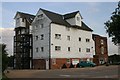
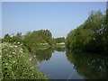
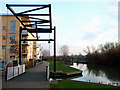
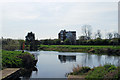
Photos of CM2 6NB


Area Information
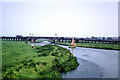
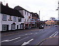
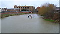
CM2 6NB is a small residential postcode in Chelmsford, Essex, encompassing parts of the Moulsham and Central Ward. With a population of 2,049, it sits within a historically significant area that includes the city’s oldest street, Moulsham Street, and the 1787 stone bridge linking to Chelmsford High Street. The area blends urban convenience with historical character, featuring medieval buildings and 19th-century industrial sites like Marconi’s first radio factory. Daily life here is shaped by proximity to the city centre, where commercial and retail activities drive the local economy. Residents benefit from a mix of residential, educational, and cultural spaces, with over 30% of Chelmsford’s jobs located within the ward. The postcode’s compact size means it is tightly integrated with the broader city, offering access to amenities while maintaining a distinct identity as part of Chelmsford’s historic core.
- Area Type
- Postcode
- Area Size
- Not available
- Population
- Not available
- Population Density
- Not available
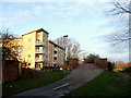
The property market in CM2 6NB is characterised by a 40% home ownership rate, with flats making up the majority of the housing stock. This suggests a rental market dominates, as fewer than half of properties are owner-occupied. The prevalence of flats indicates a focus on compact, urban living, likely catering to professionals or individuals prioritising convenience over larger homes. Given the area’s integration with Chelmsford’s city centre, properties here may benefit from proximity to employment and amenities, though the small postcode size means buyers must consider nearby areas for more housing options. The flat-dominated market may appeal to those seeking low-maintenance living, but the high crime risk could affect desirability for some buyers.
House Prices in CM2 6NB
No properties found in this postcode.
Energy Efficiency in CM2 6NB
Residents of CM2 6NB have access to a range of amenities within practical reach. The nearby retail options include Iceland Chelmsford, Tesco Chelmsford, and Aldi Parkway, offering everyday shopping convenience. Three railway stations—Chelmsford, Hatfield Peverel, and Ingatestone—provide easy access to public transport, enhancing mobility for commuters. While specific parks or leisure facilities are not detailed in the data, the area’s integration with Chelmsford’s city centre likely offers additional recreational opportunities. The presence of retail and transport hubs suggests a lifestyle focused on urban convenience, though the small postcode size means residents may need to venture slightly further for more extensive amenities.
Amenities
Schools
The nearest school to CM2 6NB is TLG Chelmsford, an independent institution. While no Ofsted rating is provided, independent schools often cater to specific educational philosophies or specialisms. The presence of a single school in the data suggests limited local educational options, though Chelmsford’s broader city centre may offer additional state or private schools within reach. Families seeking a range of school types—such as state-funded or specialist institutions—may need to look beyond the immediate area. The lack of other schools listed implies that parents should investigate further to ensure alignment with their children’s educational needs.
| Rank | School | Type | Entry gender | Ages |
|---|
Explore more schools in this area
Go to Schools tabDemographics
The population of CM2 6NB has a median age of 47, with the majority of residents aged between 30 and 64. Home ownership rates here stand at 40%, indicating a mix of owner-occupied and rental properties. The predominant accommodation type is flats, reflecting a compact housing stock suited to urban living. The predominant ethnic group is White, though specific diversity metrics are not detailed in the data. The age profile suggests a community of established adults, many of whom may be professionals or retirees. This demographic profile implies a stable, mature population with established social networks. However, the lack of detailed deprivation data means the area’s economic challenges cannot be fully assessed, though the high crime risk noted elsewhere may impact quality of life for some residents.
Household Size
Accommodation Type
Tenure
Ethnic Group
Religion
Household Composition
Age
Household Deprivation
NS-SEC
Explore more demographic insights in this area
Go to Demographics tabPlanning
Planning Constraints
- Flood RiskPremium
- Ramsar Wetland SitesPremium
- Area of Outstanding Natural BeautyPremium
- Protected Nature ReservePremium
- Protected WoodlandPremium