Area Overview for CM2 5LG
Photos of CM2 5LG


Area Information
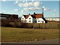
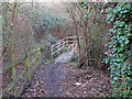
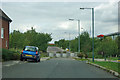
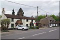
Living in CM2 5LG, part of Chelmer in Essex, offers a compact residential experience shaped by its suburban development. This small postcode area, covering just 1.2 hectares, is home to 1,263 residents, making it one of the most densely populated places in England, with over 105,000 people per square kilometre. The area was created in 2023 as a civil parish, built on former farmland in the Chelmer Valley. Its southern and eastern edges are defined by the River Chelmer, which flows into the Chelmer and Blackwater Navigation. The suburb is bordered by the A138, linking it to Chelmsford and beyond. Daily life here is characterised by proximity to Chelmsford’s amenities, with the A138 providing quick access to the town’s services. The area’s history stretches back to Saxon times, with the modern name derived from a river crossing named after Ceolmaer, a Saxon figure. Despite its recent development, CM2 5LG retains a quiet, residential feel, with housing built from the late 1970s onwards. Its small size means residents are close to both nature and urban infrastructure, though the density creates a tightly knit community.
- Area Type
- Postcode
- Area Size
- 1.2 hectares
- Population
- Not available
- Population Density
- Not available
The property market in CM2 5LG is largely owner-occupied, with 70% of homes owned by residents rather than rented. This contrasts with areas where rental demand drives the market, indicating a focus on long-term residency. The accommodation type is predominantly houses, which is unusual for a small postcode area but aligns with the suburban development’s planning. Given the limited size of CM2 5LG—just 1.2 hectares—housing stock is constrained, making the area less suited to buyers seeking a wide range of property options. However, proximity to Chelmsford and the A138 provides access to larger markets. For buyers, this means limited local choice but potential for growth through nearby areas. The high home ownership rate suggests stability, though the small size may limit future development.
House Prices in CM2 5LG
No properties found in this postcode.
Energy Efficiency in CM2 5LG
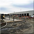
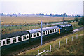
Residents of CM2 5LG have access to essential amenities within practical reach, including five retail outlets such as Sainsburys Springfield, Aldi Springfield, and the Chelmsford Star Co-operative Society. These shops provide everyday convenience, from groceries to household goods. The area’s proximity to the River Chelmer adds a natural element to daily life, though specific parks or recreational spaces are not detailed in the data. The A138 road connects to Chelmsford, offering access to larger leisure facilities, dining options, and cultural attractions. While the immediate area is small, the railway stations at Chelmsford and Hatfield Peverel open up broader opportunities for shopping, dining, and entertainment. The combination of retail proximity and transport links ensures a functional lifestyle, though the area’s compact size means residents must venture slightly beyond CM2 5LG for more extensive amenities.
Amenities
Schools
| Rank | School | Type | Entry gender | Ages |
|---|
Explore more schools in this area
Go to Schools tabDemographics
The population of CM2 5LG is predominantly adults aged 30–64, with a median age of 47. This suggests a mature, stable community, likely with established careers and families. Home ownership is high, at 70%, with the majority of properties being houses rather than flats. The predominant ethnic group is White, reflecting the area’s historical development on farmland previously tied to local manors. The high population density—over 105,000 people per square kilometre—means limited space for expansion, which can affect housing availability and community dynamics. While the data does not specify deprivation levels, the high ownership rate and adult demographic imply a relatively affluent, settled population. However, the density may also mean limited green space per household. The absence of detailed diversity statistics suggests the community is homogenous, though this is not explicitly confirmed by the data.
Household Size
Accommodation Type
Tenure
Ethnic Group
Religion
Household Composition
Age
Household Deprivation
NS-SEC
Explore more demographic insights in this area
Go to Demographics tabPlanning
Planning Constraints
- Flood RiskPremium
- Ramsar Wetland SitesPremium
- Area of Outstanding Natural BeautyPremium
- Protected Nature ReservePremium
- Protected WoodlandPremium