Area Overview for CM19 4PX
Photos of CM19 4PX
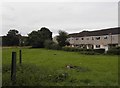
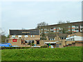
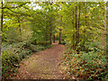
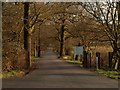
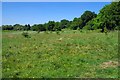
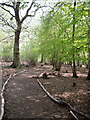
14 photos from this area
Area Information
Key information about the CM19 4PX including its size, population, and administrative classification.
- Area Type
- Postcode
- Area Size
- 9066 m²
- Population
- 1766
- Population Density
- 6813 people/km²
House Prices in CM19 4PX
31
Properties
£149,648
Average Sold Price
£54,500
Lowest Price
£306,000
Highest Price
Showing 31 properties
| Address | Type | Beds | Baths | Last Sale Price | Last Sale Date | |
|---|---|---|---|---|---|---|
| 101 Brockles Mead, Harlow, CM19 4PX | Terraced | 4 | 2 | £306,000 | Jun 2024 | |
| 108 Brockles Mead, Harlow, CM19 4PX | Terraced | 2 | 1 | £220,000 | Mar 2019 | |
| 106 Brockles Mead, Harlow, CM19 4PX | Terraced | 4 | 1 | £250,000 | Jan 2019 | |
| 107 Brockles Mead, Harlow, CM19 4PX | Terraced | 2 | 1 | £233,000 | Dec 2017 | |
| 122 Brockles Mead, Harlow, CM19 4PX | Terraced | 4 | 2 | £255,000 | Jun 2017 | |
| 100 Brockles Mead, Harlow, CM19 4PX | Terraced | 2 | 1 | £125,000 | Mar 2014 | |
| 105 Brockles Mead, Harlow, CM19 4PX | Terraced | 4 | 2 | £170,000 | Aug 2013 | |
| 104 Brockles Mead, Harlow, CM19 4PX | Terraced | 3 | 1 | £120,000 | Jul 2011 | |
| 94 Brockles Mead, Harlow, CM19 4PX | Terraced | 3 | 1 | £137,000 | Oct 2005 | |
| 121 Brockles Mead, Harlow, CM19 4PX | house | - | - | £135,000 | May 2005 |
Page 1 of 4
Energy Efficiency in CM19 4PX
Amenities
Schools
| Rank | School | Type | Entry gender | Ages |
|---|
Explore more schools in this area
Go to Schools tabDemographics
Household Size
Family (3-5 people)
most common
Accommodation Type
Houses
most common
Tenure
52
majority
Ethnic Group
White
most common
Religion
N/A
most common
Household Composition
N/A
most common
Age
47
median
Adults (30-64 years)
most common
Household Deprivation
N/A
with no deprivation
NS-SEC
22
in Lower managerial occupations
Explore more demographic insights in this area
Go to Demographics tabPlanning
Planning Constraints
- Flood RiskPremium
- Ramsar Wetland SitesPremium
- Area of Outstanding Natural BeautyPremium
- Protected Nature ReservePremium
- Protected WoodlandPremium