Area Overview for CM19 4DE
Photos of CM19 4DE

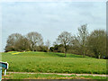

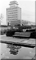

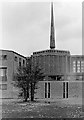
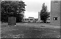

37 photos from this area
Area Information
Key information about the CM19 4DE including its size, population, and administrative classification.
- Area Type
- Postcode
- Area Size
- 7509 m²
- Population
- 1708
- Population Density
- 8348 people/km²
House Prices in CM19 4DE
27
Properties
£213,971
Average Sold Price
£59,500
Lowest Price
£346,000
Highest Price
Showing 27 properties
| Address | Type | Beds | Baths | Last Sale Price | Last Sale Date | |
|---|---|---|---|---|---|---|
| 90 Northbrooks, Harlow, CM19 4DE | Maisonette | 2 | 1 | £245,000 | Dec 2024 | |
| 100 Northbrooks, Harlow, CM19 4DE | house | - | - | £346,000 | Jun 2021 | |
| 105 Northbrooks, Harlow, CM19 4DE | house | - | - | £341,650 | Oct 2020 | |
| 87 Northbrooks, Harlow, CM19 4DE | Maisonette | 2 | 1 | £200,000 | Sep 2017 | |
| 95 Northbrooks, Harlow, CM19 4DE | Maisonette | 2 | 1 | £130,000 | May 2017 | |
| 101 Northbrooks, Harlow, CM19 4DE | Semi-detached | 3 | 1 | £300,000 | Mar 2016 | |
| 85 NORTHBROOKS, Harlow, CM19 4DE | Semi-detached | 3 | 1 | £288,500 | Nov 2015 | |
| 99 Northbrooks, Harlow, CM19 4DE | Maisonette | - | - | £110,000 | Sep 2014 | |
| 102 Northbrooks, Harlow, CM19 4DE | Terraced | 3 | 2 | £149,000 | Dec 2009 | |
| 83 Northbrooks, Harlow, CM19 4DE | house | - | - | £203,000 | Apr 2007 |
Page 1 of 3
Energy Efficiency in CM19 4DE
Amenities
Schools
| Rank | School | Type | Entry gender | Ages |
|---|
Explore more schools in this area
Go to Schools tabDemographics
Household Size
Family (3-5 people)
most common
Accommodation Type
Flats
most common
Tenure
30
majority
Ethnic Group
White
most common
Religion
N/A
most common
Household Composition
N/A
most common
Age
47
median
Adults (30-64 years)
most common
Household Deprivation
N/A
with no deprivation
NS-SEC
22
in Lower managerial occupations
Explore more demographic insights in this area
Go to Demographics tabPlanning
Planning Constraints
- Flood RiskPremium
- Ramsar Wetland SitesPremium
- Area of Outstanding Natural BeautyPremium
- Protected Nature ReservePremium
- Protected WoodlandPremium