Area Overview for CM18 7SJ
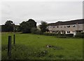
Photos of CM18 7SJ


Area Information
CM18 7SJ is a small, residential postcode area in England with a population of 1,602. It is a compact cluster of homes, predominantly houses, reflecting a mature community with a median age of 47. The area is characterised by its quiet, family-oriented atmosphere, with a strong emphasis on local amenities and connectivity. Residents benefit from proximity to primary schools, rail networks, and retail hubs, making it practical for daily life. The community is largely composed of adults aged 30–64, with home ownership at 52%, suggesting a mix of long-term residents and stable households. While the area does not have significant natural or historical landmarks, its accessibility to nearby towns and transport links positions it as a functional, low-maintenance living option. The low flood risk and absence of protected environmental sites further contribute to its appeal as a safe, straightforward place to live. For buyers seeking a modest, well-serviced area with minimal planning constraints, CM18 7SJ offers a straightforward proposition.
- Area Type
- Postcode
- Area Size
- Not available
- Population
- Not available
- Population Density
- Not available
The property market in CM18 7SJ is characterised by a 52% home ownership rate, with houses being the predominant accommodation type. This suggests a market skewed towards owner-occupied properties rather than a high-rental area. The presence of houses indicates a focus on family homes, likely with gardens and more space, which may appeal to those seeking established, low-maintenance living. Given the small size of the postcode area, the housing stock is likely limited, meaning buyers may need to consider nearby suburbs for more options. The 52% ownership rate implies that nearly half of properties are rented, potentially offering opportunities for investors or those seeking rental income. However, the lack of data on property prices or recent developments means the market’s dynamics remain opaque. For buyers, the area’s compact nature and house-centric stock could mean fewer choices but potentially more characterful properties.
House Prices in CM18 7SJ
No properties found in this postcode.
Energy Efficiency in CM18 7SJ
Residents of CM18 7SJ have access to a range of amenities within easy reach. Retail options include Co-op Maunds, Morrisons Daily, and Lidl Kingsmoor, providing essential shopping and grocery needs. The area’s rail and metro stations—such as Harlow Town and Epping—offer convenient transport links to nearby towns and London. While there are no major leisure or entertainment venues listed, the proximity to Harlow and Epping suggests access to larger facilities in these towns. The absence of parks or recreational spaces in the data means outdoor activities may require travel to nearby areas. However, the presence of multiple retail outlets and transport hubs ensures daily life is efficient, with minimal need to venture far for essentials. The lifestyle here is practical, prioritising accessibility over luxury, with a focus on stability and convenience for families and commuters.
Amenities
Schools
Residents of CM18 7SJ have access to several primary schools, including Peterswood Junior School, Peterswood Infant School and Nursery, and Longwood Primary School. Longwood Primary Academy, an Ofsted-rated “good” school, adds a note of quality to the educational options. The concentration of primary schools suggests the area is well-suited for families with young children, reducing the need for long commutes to education. The presence of two infant and junior schools indicates a structured approach to early education, with nursery provisions for younger children. While no secondary schools are listed, the proximity to nearby towns may provide additional options. The mix of schools, though limited to primary levels, ensures that families have multiple choices within walking or short driving distance. This accessibility is a key advantage for parents prioritising convenience in their children’s schooling.
| Rank | School | Type | Entry gender | Ages |
|---|
Explore more schools in this area
Go to Schools tabDemographics
The population of CM18 7SJ is 1,602, with a median age of 47, indicating a mature demographic. The majority of residents fall within the 30–64 age range, suggesting a community of established professionals and families. Home ownership stands at 52%, reflecting a balance between owner-occupied properties and rental units. The area is predominantly composed of houses, which aligns with the age profile of its residents—many of whom may be seeking stable, long-term housing. The predominant ethnic group is White, with no specific data provided on other demographics. The absence of detailed diversity statistics means the community’s composition is likely homogenous. With a population of around 1,600, the area is small enough to foster a close-knit feel but large enough to support essential services. The median age and ownership figures suggest a community that values stability and practicality over novelty or transient lifestyles.
Household Size
Accommodation Type
Tenure
Ethnic Group
Religion
Household Composition
Age
Household Deprivation
NS-SEC
Explore more demographic insights in this area
Go to Demographics tabPlanning
Planning Constraints
- Flood RiskPremium
- Ramsar Wetland SitesPremium
- Area of Outstanding Natural BeautyPremium
- Protected Nature ReservePremium
- Protected WoodlandPremium