Area Overview for CM18 7PW
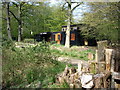
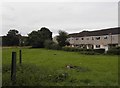
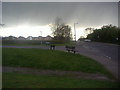
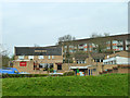
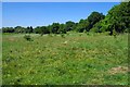
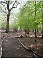
Photos of CM18 7PW


Area Information
Living in CM18 7PW means being part of a small, tightly knit residential cluster in Essex, where the population of 1,494 is spread across a compact area with a density of 1,050 people per square kilometre. This postcode lies within the Sumners and Kingsmoor electoral ward, a boundary established in 2024 following a local government review. The area is positioned near Harlow, a town known for its commuter links and suburban character. Daily life here is shaped by proximity to rail networks, with stations like Harlow Town and Roydon offering regular services to London and beyond. The area’s small size means it is likely to feel quiet and community-focused, though it remains connected to broader regional amenities. Residents benefit from nearby retail options, including M&S Southern Way Harlow BP and Co-op Maunds, while the postcode’s position near North Weald Airport adds a layer of accessibility for those needing air travel. The mix of residential housing and practical infrastructure makes CM18 7PW a pragmatic choice for those seeking a balance between tranquillity and connectivity.
- Area Type
- Postcode
- Area Size
- Not available
- Population
- 1494
- Population Density
- 1050 people/km²
The property market in CM18 7PW is dominated by owner-occupied homes, with 83% of properties owned by their residents. This high rate of home ownership contrasts with areas where rental markets dominate, suggesting a community of long-term residents rather than transient occupants. The accommodation type is primarily houses, which are more common than flats or apartments in this postcode. This housing stock likely appeals to families or individuals seeking space and privacy, typical of suburban settings. Given the small size of the area, the number of available properties may be limited, meaning buyers should consider nearby postcodes for more options. The presence of houses also implies a focus on traditional, possibly older properties, which could offer character but may require maintenance. For buyers, this area’s property market reflects a stable, low-turnover environment with a clear preference for private, family-oriented living.
House Prices in CM18 7PW
No properties found in this postcode.
Energy Efficiency in CM18 7PW
The lifestyle in CM18 7PW is shaped by its proximity to a range of amenities, from retail to transport. Local shops include M&S Southern Way Harlow BP, Co-op Maunds, and Morrisons Daily, providing everyday essentials within walking distance or a short drive. The area’s rail network, with stations like Harlow Town and Roydon, offers easy access to larger towns and cities, while the nearby Epping and Theydon Bois Underground Stations connect to London’s broader transport system. For those needing air travel, North Weald Airport is a short journey away. The mix of retail, transport, and commuter infrastructure ensures a practical, convenient lifestyle. While the area is small, its links to surrounding regions mean residents can enjoy both local amenities and broader opportunities, making it suitable for those prioritising accessibility without sacrificing a sense of community.
Amenities
Schools
| Rank | School | Type | Entry gender | Ages |
|---|
Explore more schools in this area
Go to Schools tabDemographics
The community in CM18 7PW is predominantly composed of adults aged 30–64, with a median age of 47. This suggests a mature, stable population, likely with established careers and family ties. Home ownership is high at 83%, indicating a strong presence of long-term residents rather than transient renters. The area is characterised by houses rather than flats, aligning with the demographic profile of older, family-oriented households. The predominant ethnic group is White, reflecting broader trends in the region. The population density of 1,050 people per square kilometre implies a compact, closely spaced residential layout, which may foster a sense of familiarity among neighbours. While no specific data on deprivation is provided, the high home ownership rate and age profile suggest a community with relatively stable economic conditions.
Household Size
Accommodation Type
Tenure
Ethnic Group
Religion
Household Composition
Age
Household Deprivation
NS-SEC
Explore more demographic insights in this area
Go to Demographics tabPlanning
Planning Constraints
- Flood RiskPremium
- Ramsar Wetland SitesPremium
- Area of Outstanding Natural BeautyPremium
- Protected Nature ReservePremium
- Protected WoodlandPremium