Area Overview for CM18 6XG
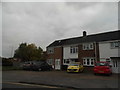
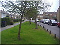
Photos of CM18 6XG


Area Information
CM18 6XG is a small residential postcode area nestled within Harlow, Essex, part of the broader Passmores electoral ward. With a population of just 1,509, it reflects a tightly knit community in a semi-rural setting. The area’s compact size means residents benefit from a quiet, localised environment, though its proximity to Harlow’s town centre and transport links offers easy access to urban amenities. Historically, the ward has undergone boundary changes, but its character remains rooted in traditional housing stock. The low population density and focus on houses suggest a community prioritising space and privacy. For those seeking a balance between tranquillity and connectivity, CM18 6XG provides a base with nearby rail and metro stations, along with essential retail and services. Its small footprint means the area is ideal for those valuing a slower pace of life without sacrificing access to regional hubs.
- Area Type
- Postcode
- Area Size
- Not available
- Population
- 1509
- Population Density
- 4911 people/km²
The property market in CM18 6XG is characterised by a high proportion of houses, with 42% of homes owned by residents. This suggests a predominance of detached or semi-detached housing stock, typical of suburban or semi-rural areas. The relatively low home ownership rate compared to national averages indicates a significant rental market, which could be due to the area’s appeal to commuters or those seeking long-term rental properties. The focus on houses rather than flats or apartments means the area is likely less suited to younger professionals or students, but more attractive to families. Given the small size of the postcode, property availability is limited, and buyers should consider nearby areas for broader options. The mix of ownership and rental properties may also influence local property prices, with potential for growth if demand from nearby towns increases.
House Prices in CM18 6XG
No properties found in this postcode.
Energy Efficiency in CM18 6XG
The lifestyle in CM18 6XG is shaped by its proximity to essential amenities. Within practical reach are five retail outlets, including Lidl Kingsmoor, Co-op Maunds, and Morrisons Daily, providing everyday shopping needs. The area’s transport links, such as Harlow Town Railway Station and Epping Underground, connect residents to broader networks for leisure, work, or travel. While the data does not list parks or leisure facilities directly, the surrounding region likely offers green spaces given Harlow’s suburban character. The presence of multiple rail and metro stations suggests a community that values accessibility, with easy access to urban centres for dining, shopping, or cultural activities. The blend of local retail and transport options ensures convenience without the need to travel far for daily necessities.
Amenities
Schools
The nearest school to CM18 6XG is Harlow Fields School and College, a special school catering to students with specific educational needs. No other schools are listed in the data, which means families relying on mainstream education may need to look further afield. The presence of a special school suggests the area is well-served for those requiring tailored support, but it does not provide a comprehensive range of primary or secondary schools. Parents seeking a full spectrum of educational options should investigate nearby wards or consider the commuting time to Harlow’s town centre, where more schools may be located. The single school type highlights a potential limitation for families prioritising a variety of educational institutions.
| Rank | School | Type | Entry gender | Ages |
|---|
Explore more schools in this area
Go to Schools tabDemographics
The median age in CM18 6XG is 47, with the majority of residents falling within the 30-64 age range. This indicates a mature, stable population, likely comprising families and professionals settled in the area. Home ownership stands at 42%, suggesting a mix of owner-occupied properties and rental units. The predominant accommodation type is houses, reflecting a preference for single-family homes over flats. The dominant ethnic group is White, though no specific diversity statistics are provided. The low median age and focus on adult households imply a community with established careers and long-term residency. With 42% of homes owned by residents, there is a balance between long-term residents and those renting, which may influence local dynamics and property availability. The absence of detailed deprivation data means the area’s socio-economic profile remains partially opaque, but the demographic stability suggests a low turnover of residents.
Household Size
Accommodation Type
Tenure
Ethnic Group
Religion
Household Composition
Age
Household Deprivation
NS-SEC
Explore more demographic insights in this area
Go to Demographics tabPlanning
Planning Constraints
- Flood RiskPremium
- Ramsar Wetland SitesPremium
- Area of Outstanding Natural BeautyPremium
- Protected Nature ReservePremium
- Protected WoodlandPremium