Area Overview for CM18 6WY
Photos of CM18 6WY


Area Information
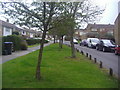
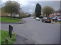
CM18 6WY is a small residential postcode cluster in Harlow, Essex, home to around 1,509 people. Situated in the East of England, this area is part of the Passmores electoral ward, which has historical roots dating back to 1976. The community is compact, with a population size that suggests a tight-knit, localised feel. The area’s proximity to Harlow’s town centre and surrounding villages offers a balance between residential tranquillity and access to urban amenities. Notably, the nearby Passmores House moated site, a Scheduled Ancient Monument, adds a layer of historical interest to the region. Daily life here is likely shaped by the surrounding infrastructure, including retail hubs, transport links, and schools. The low crime risk and absence of environmental constraints like flood zones or protected landscapes suggest a stable, low-stress environment. For those seeking a quiet yet connected place to live, CM18 6WY’s blend of historical context, practical amenities, and safety features makes it a distinct choice in Essex.
- Area Type
- Postcode
- Area Size
- Not available
- Population
- 1509
- Population Density
- 4911 people/km²
The property market in CM18 6WY is characterised by a 42% home ownership rate, with houses being the primary accommodation type. This suggests a mix of owner-occupied and rental properties, though the relatively low homeownership figure indicates a significant proportion of the housing stock is rented. The area’s small size means the market is likely limited to a handful of properties, possibly concentrated in family homes or semi-detached units. Buyers should consider that the area’s compact nature may limit availability, but the presence of nearby amenities and transport links could enhance its appeal. For those seeking a home in this postcode, the focus would likely be on properties that cater to established families, given the median age of residents. The lack of high-density housing or flats implies a quieter, more suburban character, which may align with buyers prioritising space and privacy over urban convenience.
House Prices in CM18 6WY
No properties found in this postcode.
Energy Efficiency in CM18 6WY
Living in CM18 6WY offers access to a range of nearby amenities, including five retail outlets such as Lidl Kingsmoor, Morrisons Daily, and Co-op Tye, ensuring everyday shopping needs are met. The area’s transport links, including multiple railway and underground stations, provide easy access to Harlow’s town centre, London, and surrounding towns. While specific parks or leisure facilities are not detailed in the data, the proximity to Harlow’s urban core likely offers additional recreational opportunities. The presence of North Weald Airport may also appeal to those requiring travel connections. The combination of retail, transport, and nearby infrastructure suggests a lifestyle that balances local convenience with broader connectivity, ideal for those seeking practicality without sacrificing accessibility.
Amenities
Schools
The nearest school to CM18 6WY is Harlow Fields School and College, a special school serving students with specific educational needs. No other schools are listed in the data, so this is the sole named institution within practical reach. As a special school, it suggests the area may cater to families with children requiring tailored support, though it does not provide information on mainstream education options. The absence of primary or secondary schools in the data means prospective buyers relying on local schools for children may need to look further afield. This could be a consideration for families prioritising proximity to a full range of educational institutions. However, the presence of Harlow Fields indicates some level of specialist provision, which may be a draw for certain households.
| Rank | School | Type | Entry gender | Ages |
|---|---|---|---|---|
| 1 | Harlow Fields School and College | special | N/A | N/A |
Explore more schools in this area
Go to Schools tabDemographics
The population of CM18 6WY is 1,509, with a median age of 47, indicating a community skewed toward middle-aged adults. The most common age range is 30–64 years, suggesting a stable demographic with families and working-age residents. Home ownership stands at 42%, meaning nearly half of residents live in properties they own, while the rest are likely renters. The predominant accommodation type is houses, reflecting a residential area with more detached or semi-detached properties than flats. The predominant ethnic group is White, with no specific data on other ethnicities provided. This profile suggests a mature, settled community with a focus on family living. The absence of detailed diversity metrics means the area’s cultural makeup remains less defined in the data, but the age and ownership figures imply a population prioritising stability over transient lifestyles.
Household Size
Accommodation Type
Tenure
Ethnic Group
Religion
Household Composition
Age
Household Deprivation
NS-SEC
Explore more demographic insights in this area
Go to Demographics tabPlanning
Planning Constraints
- Flood RiskPremium
- Ramsar Wetland SitesPremium
- Area of Outstanding Natural BeautyPremium
- Protected Nature ReservePremium
- Protected WoodlandPremium
- Crime RiskPremium