Area Overview for CM18 6QY
Photos of CM18 6QY


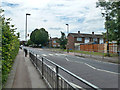

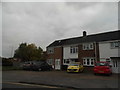


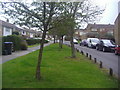
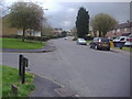
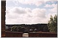
12 photos from this area
Area Information
Key information about the CM18 6QY including its size, population, and administrative classification.
- Area Type
- Postcode
- Area Size
- 4.0 hectares
- Population
- 1676
- Population Density
- 6245 people/km²
House Prices in CM18 6QY
36
Properties
£453,761
Average Sold Price
£50,000
Lowest Price
£775,000
Highest Price
Showing 36 properties
| Address | Type | Beds | Baths | Last Sale Price | Last Sale Date | |
|---|---|---|---|---|---|---|
| Windemere, Tye Green Village, Harlow, CM18 6QY | Detached | 4 | 3 | £690,000 | May 2022 | |
| Southdown, Tye Green Village, Harlow, CM18 6QY | Detached | 5 | 1 | £714,000 | Apr 2022 | |
| Bentley's, Tye Green Village, Harlow, CM18 6QY | house | - | - | £775,000 | Jun 2021 | |
| Redbric House, Tye Green Village, Harlow, CM18 6QY | Detached | 4 | 2 | £465,000 | Jan 2021 | |
| Fairview, Tye Green Village, Harlow, CM18 6QY | Detached | 3 | 3 | £465,000 | Jun 2020 | |
| Glendale Cottage, Tye Green Village, Harlow, CM18 6QY | Semi-detached | 3 | 1 | £395,000 | May 2020 | |
| Timbertop, Tye Green Village, Harlow, CM18 6QY | house | - | - | £560,000 | Jun 2018 | |
| Lancastria, Tye Green Village, Harlow, CM18 6QY | Detached | 3 | 1 | £570,000 | Jul 2017 | |
| 4 Oak End, Harlow, CM18 6QY | house | - | - | £465,000 | Apr 2016 | |
| High Tye, Tye Green Village, Harlow, CM18 6QY | Detached | 6 | 4 | £662,500 | Oct 2015 |
Page 1 of 4
Energy Efficiency in CM18 6QY
Amenities
Schools
| Rank | School | Type | Entry gender | Ages |
|---|
Explore more schools in this area
Go to Schools tabDemographics
Household Size
Family (3-5 people)
most common
Accommodation Type
Houses
most common
Tenure
56
majority
Ethnic Group
White
most common
Religion
N/A
most common
Household Composition
N/A
most common
Age
47
median
Adults (30-64 years)
most common
Household Deprivation
N/A
with no deprivation
NS-SEC
25
in Lower managerial occupations
Explore more demographic insights in this area
Go to Demographics tabPlanning
Planning Constraints
- Flood RiskPremium
- Ramsar Wetland SitesPremium
- Area of Outstanding Natural BeautyPremium
- Protected Nature ReservePremium
- Protected WoodlandPremium