Area Overview for CM18 6QL
Photos of CM18 6QL
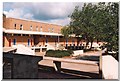
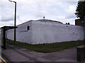

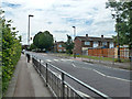
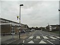
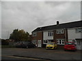

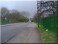
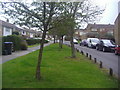
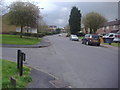
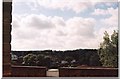
12 photos from this area
Area Information
Key information about the CM18 6QL including its size, population, and administrative classification.
- Area Type
- Postcode
- Area Size
- 7910 m²
- Population
- 1676
- Population Density
- 6245 people/km²
House Prices in CM18 6QL
29
Properties
£208,153
Average Sold Price
£75,000
Lowest Price
£325,000
Highest Price
Showing 29 properties
| Address | Type | Beds | Baths | Last Sale Price | Last Sale Date | |
|---|---|---|---|---|---|---|
| 119 Hookfield, Harlow, CM18 6QL | Terraced | 3 | 1 | £325,000 | Apr 2025 | |
| 128 Hookfield, Harlow, CM18 6QL | house | 3 | - | £300,000 | Mar 2021 | |
| 133 Hookfield, Harlow, CM18 6QL | Terraced | 3 | 1 | £275,000 | Nov 2020 | |
| 140 Hookfield, Harlow, CM18 6QL | house | - | - | £275,000 | Aug 2019 | |
| 122 Hookfield, Harlow, CM18 6QL | house | - | - | £258,500 | Jun 2019 | |
| 124 Hookfield, Harlow, CM18 6QL | Terraced | 3 | - | £260,000 | May 2018 | |
| 114 Hookfield, Harlow, CM18 6QL | Terraced | 3 | 1 | £149,000 | Jan 2014 | |
| 115 Hookfield, Harlow, CM18 6QL | Terraced | 3 | 1 | £172,000 | Feb 2013 | |
| 127 Hookfield, Harlow, CM18 6QL | house | - | - | £160,000 | Mar 2012 | |
| 112 Hookfield, Harlow, CM18 6QL | Terraced | 3 | 1 | £150,000 | Aug 2009 |
Page 1 of 3
Energy Efficiency in CM18 6QL
Amenities
Schools
| Rank | School | Type | Entry gender | Ages |
|---|
Explore more schools in this area
Go to Schools tabDemographics
Household Size
Family (3-5 people)
most common
Accommodation Type
Houses
most common
Tenure
56
majority
Ethnic Group
White
most common
Religion
N/A
most common
Household Composition
N/A
most common
Age
47
median
Adults (30-64 years)
most common
Household Deprivation
N/A
with no deprivation
NS-SEC
25
in Lower managerial occupations
Explore more demographic insights in this area
Go to Demographics tabPlanning
Planning Constraints
- Flood RiskPremium
- Ramsar Wetland SitesPremium
- Area of Outstanding Natural BeautyPremium
- Protected Nature ReservePremium
- Protected WoodlandPremium