Area Overview for CM18 6LF
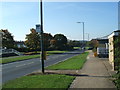
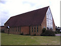
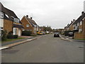
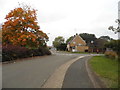
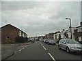
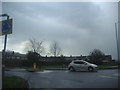
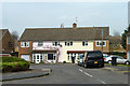
Photos of CM18 6LF


Area Information
CM18 6LF is a small residential postcode area in Harlow, Essex, home to 1,433 residents. It forms part of the Bush Fair ward, a defined residential estate primarily managed by South Anglia Housing Association. Most properties were built around 2000, featuring pitched roofs typical of modern suburban housing. The area is compact, with a close-knit community feel, though its low population suggests a quiet, unassuming character. Located in Eastern England, it benefits from proximity to Harlow’s town centre and surrounding amenities. While not a sprawling suburb, it offers a mix of local shops, transport links, and schools. The area’s demographics reflect a mature population, with a median age of 47, indicating a stable, family-oriented environment. For buyers, CM18 6LF represents a niche market, where property choices are limited but focused on owner-occupied homes. Its small size means residents are likely to know their neighbours, though the area’s remoteness from major cities may appeal to those prioritising tranquillity over urban convenience.
- Area Type
- Postcode
- Area Size
- Not available
- Population
- 1433
- Population Density
- 3719 people/km²
The property market in CM18 6LF is defined by a 42% home ownership rate, meaning just over a third of properties are owner-occupied, while the remainder are likely rented. The area is predominantly composed of houses, with no mention of flats or apartments, suggesting a traditional suburban layout. This mix implies a rental market that may cater to both long-term tenants and short-term lets, though the low population and small size of the area limit the scale of the market. Buyers should expect a limited selection of properties, as the area is a small, defined postcode cluster. The housing stock, primarily built around 2000, may appeal to those seeking modern, family-friendly homes. However, the low home ownership rate and lack of data on property prices or types mean the market remains opaque. Prospective buyers should consider the area’s proximity to Harlow’s amenities and transport links when evaluating its appeal.
House Prices in CM18 6LF
Showing 1 properties
| Address | Type | Beds | Baths | Last Sale Price | Last Sale Date | |
|---|---|---|---|---|---|---|
| Essex County Council, West Division Youth, Brays House, Tracyes Road, Harlow, CM18 6LF | Office | - | - | - | - |
Energy Efficiency in CM18 6LF
The lifestyle in CM18 6LF is shaped by its proximity to essential amenities. Retail options include Co-op Manor, Morrisons Daily, and other local stores, providing convenience for daily shopping. The area’s rail stations, such as Harlow Town and Harlow Mill, offer access to broader retail and leisure opportunities in Harlow town centre. While there is no mention of parks or recreational spaces in the data, the nearby schools and transport links suggest a focus on family-friendly living. The presence of North Weald Airport adds a unique element, though it may not directly influence the local lifestyle. Residents can access a range of services through nearby stations and shops, though the area’s small size means it lacks large-scale entertainment or dining venues. The combination of retail, transport, and educational facilities creates a functional, if modest, lifestyle for those prioritising practicality over urban vibrancy.
Amenities
Schools
Residents of CM18 6LF have access to several primary schools, including Holy Cross Catholic Primary School, Harlow, which holds an Ofsted rating of ‘good’. The Brays Grove Community School and Purford Green Primary School also serve the area, with both rated ‘good’ by Ofsted. Additionally, Passmores Academy, an academy school, provides secondary education nearby, also rated ‘good’. This mix of primary and secondary options ensures families have multiple choices, though all schools are rated as good rather than outstanding. The presence of multiple schools within practical reach suggests a focus on education, making the area suitable for families. However, the absence of data on school catchment areas or student performance means potential buyers should verify whether specific schools are accessible to their children. The overall quality of education appears solid, but no information is available on specialist provision or extracurricular offerings.
| Rank | School | Type | Entry gender | Ages |
|---|
Explore more schools in this area
Go to Schools tabDemographics
The population of CM18 6LF is 1,433, with a median age of 47. This suggests a community dominated by adults aged 30–64, reflecting a mature demographic profile. Home ownership stands at 42%, indicating a significant proportion of residents rent their homes. The area is characterised by houses rather than flats or apartments, aligning with its suburban, low-density layout. The predominant ethnic group is White, with no data provided on other ethnicities. The age range and home ownership figures suggest a stable, established population, likely with long-term residents rather than transient renters. This demographic profile implies a community with fewer young families compared to other areas, though the presence of primary schools nearby indicates some family households. The absence of specific data on deprivation or income levels means the quality of life cannot be fully contextualised, but the age and ownership statistics suggest a balanced, middle-aged population with moderate housing needs.
Household Size
Accommodation Type
Tenure
Ethnic Group
Religion
Household Composition
Age
Household Deprivation
NS-SEC
Explore more demographic insights in this area
Go to Demographics tabPlanning
Planning Constraints
- Flood RiskPremium
- Ramsar Wetland SitesPremium
- Area of Outstanding Natural BeautyPremium
- Protected Nature ReservePremium
- Protected WoodlandPremium