Area Overview for CM18 6LE
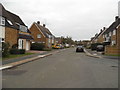
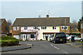
Photos of CM18 6LE


Area Information
CM18 6LE is a small residential cluster in Harlow, Essex, with a population of 1870. It lies within the Bush Fair ward, a defined estate developed by South Anglia Housing Association around 2000, featuring homes with pitched roofs. The area’s compact size fosters a tight-knit community feel, typical of smaller postcode clusters. Its location in the Harlow district offers proximity to regional amenities while maintaining a suburban character. With a median age of 47 and a population skewed toward adults aged 30–64, the area reflects a mature demographic, suggesting a mix of established families and long-term residents. The housing stock is predominantly owner-occupied, though at 39% home ownership, rental options are more prevalent. This balance may appeal to those seeking stability without the pressure of property ownership. The area’s quiet, low-density layout contrasts with nearby urban hubs, offering a blend of residential comfort and practical connectivity.
- Area Type
- Postcode
- Area Size
- Not available
- Population
- 1870
- Population Density
- 6105 people/km²
The property market in CM18 6LE is characterised by a 39% home ownership rate, indicating that rental properties outnumber owner-occupied homes. The accommodation type is predominantly houses, suggesting a focus on family-friendly, low-density housing. Given the area’s small size and defined estate development, the housing stock is limited, with few new builds likely to emerge. This dynamic positions the area as more of a rental market than a buyer’s market, though existing homes may offer value for those prioritising stability over investment potential. The presence of South Anglia Housing Association as a major owner hints at a mix of social and private rentals. Buyers should consider the area’s compact nature, which may limit property choices but also preserve a cohesive, low-traffic residential environment.
House Prices in CM18 6LE
No properties found in this postcode.
Energy Efficiency in CM18 6LE
The lifestyle in CM18 6LE is shaped by its proximity to retail, transport, and regional hubs. Five retail venues, including Morrisons Daily and Co-op Tye, provide everyday shopping options within easy reach. Rail and metro stations offer seamless access to London and Essex’s broader network, while North Weald Airport adds flexibility for travel. The area’s small size means amenities are concentrated, fostering a self-contained feel. Though not a bustling commercial centre, the mix of shops, transport links, and nearby green spaces supports a practical, low-stress lifestyle. Residents can enjoy suburban convenience without the congestion of larger urban areas, making it suitable for those valuing accessibility and simplicity.
Amenities
Schools
The schools nearest to CM18 6LE include William Martin CofE VC Infant and Nursery School in Harlow, a primary school, and William Martin Church of England Infant and Nursery School, an academy. Both institutions cater to younger children, offering early education options for families. The presence of two schools within the area suggests a focus on foundational education, though no data on Ofsted ratings or academic performance is provided. The mix of a traditional primary school and an academy may offer parents choice in educational approaches, though the lack of secondary schools nearby means older children would need to commute. This dynamic is typical of smaller postcode areas, where schools are often concentrated at the primary level.
| Rank | School | Type | Entry gender | Ages |
|---|
Explore more schools in this area
Go to Schools tabDemographics
The population of CM18 6LE is 1870, with a median age of 47. The most common age range is 30–64 years, indicating a mature, settled community with limited representation of younger or older demographics. Home ownership stands at 39%, suggesting a higher proportion of rental properties compared to the national average. The accommodation type is predominantly houses, aligning with the area’s suburban character. The predominant ethnic group is White, reflecting the broader demographic patterns of the Harlow district. While no specific data on deprivation is provided, the age profile and home ownership rate imply a community focused on long-term stability rather than transient populations. This demographic structure may influence local services and amenities, tailored to the needs of middle-aged residents and families.
Household Size
Accommodation Type
Tenure
Ethnic Group
Religion
Household Composition
Age
Household Deprivation
NS-SEC
Explore more demographic insights in this area
Go to Demographics tabPlanning
Planning Constraints
- Flood RiskPremium
- Ramsar Wetland SitesPremium
- Area of Outstanding Natural BeautyPremium
- Protected Nature ReservePremium
- Protected WoodlandPremium