Area Overview for CM18 6JE
Photos of CM18 6JE

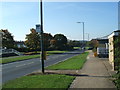
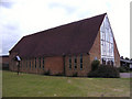
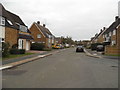
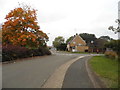


15 photos from this area
Area Information
Key information about the CM18 6JE including its size, population, and administrative classification.
- Area Type
- Postcode
- Area Size
- 6842 m²
- Population
- 1673
- Population Density
- 6579 people/km²
House Prices in CM18 6JE
26
Properties
£230,850
Average Sold Price
£141,500
Lowest Price
£332,000
Highest Price
Showing 26 properties
| Address | Type | Beds | Baths | Last Sale Price | Last Sale Date | |
|---|---|---|---|---|---|---|
| 63 Tilbury Mead, Harlow, CM18 6JE | Terraced | 2 | 1 | £332,000 | Mar 2025 | |
| 49 Tilbury Mead, Harlow, CM18 6JE | Terraced | 2 | 1 | £305,000 | Dec 2022 | |
| 56 Tilbury Mead, Harlow, CM18 6JE | Retail | 3 | 1 | £305,000 | Mar 2022 | |
| 50 Tilbury Mead, Harlow, CM18 6JE | Terraced | 3 | 1 | £322,000 | Dec 2021 | |
| 43 Tilbury Mead, Harlow, CM18 6JE | Terraced | 3 | 1 | £220,000 | Sep 2015 | |
| 40 Tilbury Mead, Harlow, CM18 6JE | house | - | - | £200,000 | Jun 2015 | |
| 47 Tilbury Mead, Harlow, CM18 6JE | Terraced | 3 | - | £161,000 | Nov 2013 | |
| 60 Tilbury Mead, Harlow, CM18 6JE | Terraced | 3 | - | £176,000 | Jul 2013 | |
| 58 Tilbury Mead, Harlow, CM18 6JE | house | 3 | - | £146,000 | Mar 2006 | |
| 42 Tilbury Mead, Harlow, CM18 6JE | Terraced | - | - | £141,500 | May 2004 |
Page 1 of 3
Energy Efficiency in CM18 6JE
Amenities
Schools
| Rank | School | Type | Entry gender | Ages |
|---|
Explore more schools in this area
Go to Schools tabDemographics
Household Size
Family (3-5 people)
most common
Accommodation Type
Houses
most common
Tenure
54
majority
Ethnic Group
White
most common
Religion
N/A
most common
Household Composition
N/A
most common
Age
47
median
Adults (30-64 years)
most common
Household Deprivation
N/A
with no deprivation
NS-SEC
23
in Lower managerial occupations
Explore more demographic insights in this area
Go to Demographics tabPlanning
Planning Constraints
- Flood RiskPremium
- Ramsar Wetland SitesPremium
- Area of Outstanding Natural BeautyPremium
- Protected Nature ReservePremium
- Protected WoodlandPremium