Area Overview for CM18 6DP
Photos of CM18 6DP
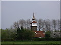

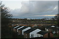
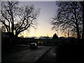
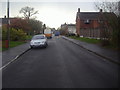
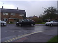


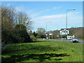
14 photos from this area
Area Information
Key information about the CM18 6DP including its size, population, and administrative classification.
- Area Type
- Postcode
- Area Size
- 6.0 hectares
- Population
- 1484
- Population Density
- 2233 people/km²
House Prices in CM18 6DP
26
Properties
£215,755
Average Sold Price
£68,995
Lowest Price
£370,000
Highest Price
Showing 26 properties
| Address | Type | Beds | Baths | Last Sale Price | Last Sale Date | |
|---|---|---|---|---|---|---|
| 114 Great Brays, Harlow, CM18 6DP | Terraced | 2 | 1 | £306,220 | Jul 2025 | |
| 106 Great Brays, Harlow, CM18 6DP | house | - | - | £370,000 | Feb 2022 | |
| 121 Great Brays, Harlow, CM18 6DP | Terraced | - | - | £285,000 | Jan 2022 | |
| 117 Great Brays, Harlow, CM18 6DP | Terraced | 2 | 1 | £253,000 | Dec 2020 | |
| 109 Great Brays, Harlow, CM18 6DP | house | - | - | £262,500 | Sep 2018 | |
| 110 Great Brays, Harlow, CM18 6DP | Terraced | 2 | 1 | £272,000 | Jan 2018 | |
| 112 Great Brays, Harlow, CM18 6DP | Terraced | 2 | 1 | £177,000 | Jun 2017 | |
| 118 Great Brays, Harlow, CM18 6DP | house | - | - | £197,000 | Nov 2015 | |
| 105 Great Brays, Harlow, CM18 6DP | Terraced | 2 | - | £173,000 | Jan 2014 | |
| 123 Great Brays, Harlow, CM18 6DP | house | - | - | £145,600 | Apr 2013 |
Page 1 of 3
Energy Efficiency in CM18 6DP
Amenities
Schools
| Rank | School | Type | Entry gender | Ages |
|---|
Explore more schools in this area
Go to Schools tabDemographics
Household Size
Family (3-5 people)
most common
Accommodation Type
Houses
most common
Tenure
37
majority
Ethnic Group
White
most common
Religion
N/A
most common
Household Composition
N/A
most common
Age
47
median
Adults (30-64 years)
most common
Household Deprivation
N/A
with no deprivation
NS-SEC
19
in Lower managerial occupations
Explore more demographic insights in this area
Go to Demographics tabPlanning
Planning Constraints
- Flood RiskPremium
- Ramsar Wetland SitesPremium
- Area of Outstanding Natural BeautyPremium
- Protected Nature ReservePremium
- Protected WoodlandPremium