Area Overview for CM18 6BP
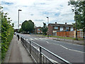
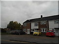
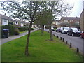
Photos of CM18 6BP


Area Information
Living in CM18 6BP means being part of a small, tightly knit residential cluster in Harlow, Essex. With a population of 1,676, this postcode area is defined by its modest scale and proximity to key local amenities. The area is part of the Bush Fair ward, a residential estate primarily developed by South Anglia Housing Association, with homes built around 2000 featuring pitched roofs. While the community is compact, it benefits from connections to nearby towns and transport networks. Daily life here is shaped by its suburban character, with a focus on family-oriented living. The area’s low crime risk and absence of environmental constraints make it a practical choice for those seeking stability. Residents are likely to find a balance between quiet living and access to essential services, from retail to public transport. Its location in Harlow, a town with growing infrastructure, adds to its appeal for those prioritising convenience without the pressures of larger urban centres.
- Area Type
- Postcode
- Area Size
- Not available
- Population
- 1676
- Population Density
- 6245 people/km²
The property market in CM18 6BP is characterised by a 56% home ownership rate, with houses forming the majority of accommodation types. This suggests a predominantly owner-occupied area, though the relatively low ownership rate indicates a notable rental market. The presence of housing developed by South Anglia Housing Association points to a mix of social and private properties, which may influence price ranges and availability. Given the area’s small size and suburban nature, properties here are likely to be family homes with garden spaces, appealing to buyers seeking stability. However, the limited scale of the area means the immediate surroundings offer few alternative housing options, potentially reducing competition for properties. Buyers should consider the estate’s age, with homes built around 2000, which may impact long-term maintenance costs and desirability.
House Prices in CM18 6BP
No properties found in this postcode.
Energy Efficiency in CM18 6BP
The lifestyle in CM18 6BP is shaped by its proximity to retail, transport, and leisure options. Five retail outlets, including Morrisons Daily and Co-op Tye, provide essential shopping within walking distance. Rail and metro stations offer seamless access to Harlow, London, and surrounding areas, making commuting efficient. The nearby North Weald Airport, while not a major hub, adds to the area’s accessibility. For leisure, the absence of major parks or cultural venues is offset by the convenience of suburban amenities. The mix of retail and transport options ensures daily life is practical, with minimal need to travel far for essentials. This balance of accessibility and quiet living makes CM18 6BP suitable for those valuing convenience without sacrificing a low-stress environment.
Amenities
Schools
Residents of CM18 6BP have access to two schools within practical reach. The William Martin Church of England Voluntary Controlled Junior School in Harlow serves as a primary school, offering a faith-based education. Nearby, the William Martin Church of England Junior School is an academy with a Good Ofsted rating, indicating a strong educational standard. The combination of a voluntary controlled school and an academy provides families with options, whether they prioritise religious affiliation or academic performance. Both institutions are likely to serve the area’s primary age group, with the academy’s rating suggesting a reliable, well-regarded educational environment. The proximity of these schools to CM18 6BP makes it an attractive option for families seeking established schooling without long commutes.
| Rank | School | Type | Entry gender | Ages |
|---|
Explore more schools in this area
Go to Schools tabDemographics
The community in CM18 6BP is predominantly composed of adults aged 30–64, with a median age of 47. This suggests a mature, established population, likely with long-term ties to the area. Home ownership stands at 56%, indicating a mix of owner-occupied properties and rental units. The accommodation type is primarily houses, reflecting a suburban layout rather than high-density housing. The predominant ethnic group is White, though no specific diversity metrics are provided. The age profile and ownership figures suggest a stable, low-turnover community, with residents potentially prioritising family homes over transient living arrangements. The absence of data on deprivation means the area’s socioeconomic challenges cannot be assessed, but the low crime risk and lack of environmental constraints imply a generally secure and manageable living environment.
Household Size
Accommodation Type
Tenure
Ethnic Group
Religion
Household Composition
Age
Household Deprivation
NS-SEC
Explore more demographic insights in this area
Go to Demographics tabPlanning
Planning Constraints
- Flood RiskPremium
- Ramsar Wetland SitesPremium
- Area of Outstanding Natural BeautyPremium
- Protected Nature ReservePremium
- Protected WoodlandPremium