Area Overview for CM17 9TJ
Photos of CM17 9TJ


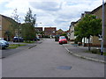

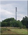


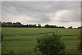
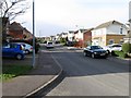
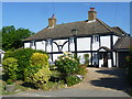

14 photos from this area
Area Information
Key information about the CM17 9TJ including its size, population, and administrative classification.
- Area Type
- Postcode
- Area Size
- 2.1 hectares
- Population
- 2342
- Population Density
- 8279 people/km²
House Prices in CM17 9TJ
64
Properties
£259,031
Average Sold Price
£82,109
Lowest Price
£614,000
Highest Price
Showing 64 properties
| Address | Type | Beds | Baths | Last Sale Price | Last Sale Date | |
|---|---|---|---|---|---|---|
| 83 Davenport, Harlow, CM17 9TJ | Terraced | 2 | 1 | £350,000 | Dec 2025 | |
| 100 Davenport, Harlow, CM17 9TJ | Terraced | 2 | 1 | £357,000 | Nov 2025 | |
| 106 Davenport, Harlow, CM17 9TJ | Terraced | 2 | 1 | £330,000 | Dec 2024 | |
| 112 Davenport, Harlow, CM17 9TJ | Terraced | 2 | 1 | £280,000 | Oct 2024 | |
| 75 Davenport, Harlow, CM17 9TJ | Terraced | 2 | 1 | £350,000 | Jul 2024 | |
| 84 Davenport, Harlow, CM17 9TJ | Terraced | 2 | 1 | £337,500 | Aug 2023 | |
| 107 Davenport, Harlow, CM17 9TJ | Terraced | 2 | 1 | £350,000 | Aug 2023 | |
| 121 Davenport, Harlow, CM17 9TJ | Bungalow | 2 | 2 | £430,000 | Aug 2023 | |
| 62 Davenport, Harlow, CM17 9TJ | Terraced | 2 | 1 | £465,000 | May 2023 | |
| 70 Davenport, Harlow, CM17 9TJ | Semi-detached | 3 | 1 | £399,000 | Apr 2023 |
Page 1 of 7
Energy Efficiency in CM17 9TJ
Amenities
Schools
| Rank | School | Type | Entry gender | Ages |
|---|
Explore more schools in this area
Go to Schools tabDemographics
Household Size
Family (3-5 people)
most common
Accommodation Type
Houses
most common
Tenure
82
majority
Ethnic Group
White
most common
Religion
N/A
most common
Household Composition
N/A
most common
Age
47
median
Adults (30-64 years)
most common
Household Deprivation
N/A
with no deprivation
NS-SEC
37
in Lower managerial occupations
Explore more demographic insights in this area
Go to Demographics tabPlanning
Planning Constraints
- Flood RiskPremium
- Ramsar Wetland SitesPremium
- Area of Outstanding Natural BeautyPremium
- Protected Nature ReservePremium
- Protected WoodlandPremium