Area Overview for CM17 9NG
Photos of CM17 9NG
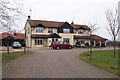
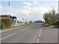
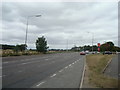
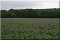


24 photos from this area
Area Information
Key information about the CM17 9NG including its size, population, and administrative classification.
- Area Type
- Postcode
- Area Size
- 46.8 hectares
- Population
- 2350
- Population Density
- 87 people/km²
House Prices in CM17 9NG
14
Properties
£308,125
Average Sold Price
£287,500
Lowest Price
£335,000
Highest Price
Showing 14 properties
| Address | Type | Beds | Baths | Last Sale Price | Last Sale Date | |
|---|---|---|---|---|---|---|
| Baytree Cottage, London Road, Hastingwood, Harlow, CM17 9NG | Terraced | 2 | 1 | £335,000 | Apr 2017 | |
| Caroline Cottage, London Road, Hastingwood, Harlow, CM17 9NG | house | 3 | - | £315,000 | Dec 2011 | |
| End House, London Road, Hastingwood, Harlow, CM17 9NG | house | - | - | £295,000 | Jul 2009 | |
| Maya, London Road, Hastingwood, Harlow, CM17 9NG | Detached | - | - | £287,500 | May 2002 | |
| Hill Cottage, London Road, Hastingwood, Harlow, CM17 9NG | Cottage | 2 | 1 | - | - | |
| Hill House, London Road, Hastingwood, Harlow, CM17 9NG | Detached | - | - | - | - | |
| Vanwise Group, London Road, Hastingwood, Harlow, CM17 9NG | shop | - | - | - | - | |
| Filling Station, Arlington Motor Company, London Road, Hastingwood, Harlow, CM17 9NG | Retail | - | - | - | - | |
| Arlington Motor Company, London Road, Hastingwood, Harlow, CM17 9NG | shop | - | - | - | - | |
| M11 Motorway Service Area, London Road, North Weald, Harlow, CM17 9NG | shop | - | - | - | - |
Page 1 of 2
Energy Efficiency in CM17 9NG
Amenities
Schools
| Rank | School | Type | Entry gender | Ages |
|---|
Explore more schools in this area
Go to Schools tabDemographics
Household Size
Family (3-5 people)
most common
Accommodation Type
Houses
most common
Tenure
77
majority
Ethnic Group
White
most common
Religion
N/A
most common
Household Composition
N/A
most common
Age
47
median
Adults (30-64 years)
most common
Household Deprivation
N/A
with no deprivation
NS-SEC
39
in Lower managerial occupations
Explore more demographic insights in this area
Go to Demographics tabPlanning
Planning Constraints
- Flood RiskPremium
- Ramsar Wetland SitesPremium
- Area of Outstanding Natural BeautyPremium
- Protected Nature ReservePremium
- Protected WoodlandPremium