Area Overview for CM17 9HY
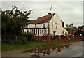
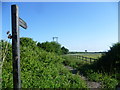
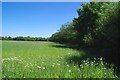
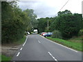
Photos of CM17 9HY


Area Information
CM17 9HY is a small residential postcode in England, covering 5,249 square metres and home to 2,350 residents. Its compact size and modest population reflect a quiet, close-knit community. The area is part of a broader rural landscape with historical roots, including medieval forestry and 19th-century developments. While not a densely populated region, it offers a mix of rural charm and practical connectivity. The median age of 47 suggests a mature demographic, with a strong presence of adults aged 30–64. Most residents own their homes, and the area is characterised by single-family houses rather than flats or apartments. Proximity to North Weald Bassett, a village with historic sites like St Andrew’s Church and Weald Hall, adds cultural depth. Daily life here balances local traditions with modern amenities, including nearby shops, rail links, and airfield access. The area’s low flood risk and absence of protected natural sites make it a stable, low-constraint location. For buyers seeking a quieter lifestyle with practical infrastructure, CM17 9HY offers a blend of seclusion and accessibility.
- Area Type
- Postcode
- Area Size
- 5249 m²
- Population
- 2350
- Population Density
- 87 people/km²
CM17 9HY is a predominantly owner-occupied area, with 77% of residents living in their own homes. The accommodation type is exclusively houses, with no flats or apartments reported, suggesting a housing stock focused on single-family residences. This contrasts with urban areas where rental properties and mixed-use developments are common. The small size of the postcode—just 5,249 square metres—means the property market is limited in scale, with few new developments likely to arise. For buyers, this implies a niche market with limited stock, where properties are likely to be in established, older homes rather than modern builds. The absence of rental data suggests the area is not a hotspot for investors seeking short-term returns. Given the high home ownership rate, properties here may appreciate in value over time, particularly if demand from local families or commuters persists. Prospective buyers should consider the area’s small size and limited expansion potential when evaluating long-term viability.
House Prices in CM17 9HY
No properties found in this postcode.
Energy Efficiency in CM17 9HY
Living in CM17 9HY offers access to a range of amenities within practical reach. Retail options include Morrisons Daily, Tesco Harlow, and M&S Harlow Gate BP, providing everyday shopping needs. The area is served by four railway stations, including Harlow Mill and Epping Underground, facilitating travel to nearby towns and cities. North Weald Airport is nearby, offering regional flight connections. While the data does not list parks or leisure facilities explicitly, the proximity to North Weald Bassett—a village with historic sites like St Andrew’s Church and Weald Hall—suggests opportunities for cultural and recreational activities. The presence of a primary school and nearby retail hubs indicates a community focused on practical living, with a balance between local services and the need to travel for more specialised amenities. The area’s small size means residents are likely to know their neighbours, fostering a close-knit environment.
Amenities
Schools
The nearest school to CM17 9HY is Sheering Church of England Voluntary Controlled Primary School, which provides primary education for children in the area. Its Ofsted rating is described as “satisfactory,” indicating it meets basic standards but may have room for improvement in specific areas. The absence of secondary schools in the data means families may need to look beyond CM17 9HY for secondary education, potentially requiring travel to nearby towns like Harlow or Epping. The presence of a primary school suggests the area supports young families, though the lack of higher education options could be a consideration for those planning for older children. The school’s status as a voluntary controlled school implies a partnership between the local church and state education system, which may influence its curriculum or community involvement. For parents prioritising proximity to schools, this primary institution is a key asset, but additional research into secondary options is necessary.
| Rank | School | Type | Entry gender | Ages |
|---|
Explore more schools in this area
Go to Schools tabDemographics
The population of CM17 9HY is 2,350, with a median age of 47, indicating a predominantly middle-aged and older demographic. The most common age range is adults aged 30–64, suggesting a community focused on established families and long-term residency. Home ownership is high at 77%, reflecting a stable housing market where most residents live in their own homes rather than renting. The accommodation type is primarily houses, with no mention of flats or shared housing, pointing to a residential area with larger properties. The predominant ethnic group is White, with no specific data on other demographics. The population density of 87 people per square kilometre is low, aligning with a rural or semi-rural setting. This profile implies a community with limited generational turnover, where residents are likely to have lived in the area for many years. The absence of detailed diversity metrics means the area’s social fabric is less documented, but the data highlights a settled, mature population with a strong sense of local identity.
Household Size
Accommodation Type
Tenure
Ethnic Group
Religion
Household Composition
Age
Household Deprivation
NS-SEC
Explore more demographic insights in this area
Go to Demographics tabPlanning
Planning Constraints
- Flood RiskPremium
- Ramsar Wetland SitesPremium
- Area of Outstanding Natural BeautyPremium
- Protected Nature ReservePremium
- Protected WoodlandPremium