Area Overview for CM16 6PF
Photos of CM16 6PF
Area Information
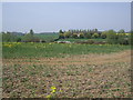
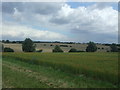
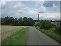
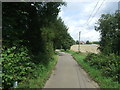
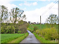
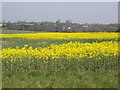
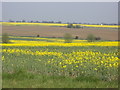
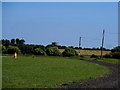
Living in CM16 6PF means settling into a specific postcode area that covers a small residential cluster within the rural civil parish of Epping Upland. This location sits in the Epping Forest District of Essex, representing the original, more rural north-western part of the ancient parish. The area encompasses 64.1 hectares of land supporting a population of 2,294 residents. You are stepping into a setting defined by its separation from the urban sprawl of Epping town, having been historically distinct since the parish split in 1896. Archaeological evidence suggests human settlement here as early as 7500 BC, yet the current character reflects this long-standing connection to the edge of Epping Forest. The landscape is dominated by houses rather than urban developments, preserving a link to the scattered farms and chapel that defined the Domesday Book entry for this community in 1086. All Saints Church stands as a notable feature, its nave and chancel dating back to the 13th century. Daily life here is influenced by proximity to the woodland, offering a contrast to the busy town centre while maintaining practical access to modern conveniences. This postcode serves as a quiet node where history meets contemporary living.
- Area Type
- Postcode
- Area Size
- 64.1 hectares
- Population
- 2294
- Population Density
- 81 people/km²
The property market in CM16 6PF is characterised by a very strong bias toward owner-occupation. With 80% of residents owning their homes, the area functions primarily as a market for existing owners looking to move up or down market rather than a hub for private rentals. The accommodation type is strictly houses, meaning you will find detached, semi-detached, or terraced family homes rather than flats or apartments. This homogeneity suggests a stable housing stock suited to families and retirees rather than young professionals or students seeking city living. As a small postcode area covering only 64.1 hectares, supply is naturally limited, putting value on established properties. The lack of rental properties implies that moving into this area typically requires purchasing an existing home. Buyers looking at this location are joining a community where property turnover is likely lower than in urban centres. The historical context of the 1896 parish split adds to the exclusivity of the stock, as many homes date back to the era when the rural north-western part was separated from Epping town.
House Prices in CM16 6PF
Showing 3 properties
| Address | Type | Beds | Baths | Last Sale Price | Last Sale Date | |
|---|---|---|---|---|---|---|
| Marles Stud, Epping Road, Epping Upland, Epping, CM16 6PF | Semi-detached | 5 | 4 | £3,495,000 | Feb 2017 | |
| Marles Farm Cottage, Upland Road, Epping Upland, Epping, CM16 6PF | Detached | - | - | £450,000 | Feb 1998 | |
| Marles Farm, Upland Road, Epping Upland, Epping, CM16 6PF | house | - | - | - | - |
Energy Efficiency in CM16 6PF
Residents of CM16 6PF enjoy access to five key retail outlets within practical reach for daily shopping needs. You can visit Co-op Maunds, Morrisons Daily, or Lidl Kingsmoor to handle your grocery and household shopping. These stores provide a balanced selection of premium and budget options without the need for extensive supermarkets in the immediate village. Leisure and transport amenities are equally accessible, with three underground stations and five railway stations nearby. North Weald Airport serves as the nearest airport facility, and a variety of leisure options cluster around Epping Town, which is part of the same administrative district. Living in CM16 6PF means you are close to the historical core of the area while maintaining easy access to these modern facilities. Epping Upland itself features the old All Saints Church and stands on the edge of Epping Forest, offering local green space. The combination of rural housing and near-city amenities creates a convenient lifestyle for those who do not wish to live in a town centre. Public transport nodes like Debden and Theydon Bois offer straightforward commutes if you work in central London or Harlow.
Amenities
Schools
Families living in CM16 6PF have access to two primary education options within the immediate area. Epping Upland Church of England Primary School serves as the main nearby facility, offering religious education within a primary setting. A second option is Epping Upland CofE Primary School, which shares the same village name and educational type. Both institutions fall under the broader umbrella of primary education for young children in the parish. There is no data provided in the current scope regarding secondary schools, forcing families at this stage of their lives to look outside the immediate postcode for older children's education. The mix of school names, including the variation between "Church of England" and "CofE", indicates a established local educational infrastructure that has served the community since the parish split. Choosing between these two primary schools is the main decision point for parents moving into this rural setting. The concentration of schools on the parish itself underscores the rural, village-focused nature of daily life in this area.
| Rank | School | Type | Entry gender | Ages |
|---|
Explore more schools in this area
Go to Schools tabDemographics
The community in CM16 6PF is defined by a settled population with a median age of 47 years. Adults between the ages of 30 and 64 constitute the most common age range within this residential cluster. Homeownership is the dominant trend, with exactly 80% of households owning their properties. The accommodation type is exclusively houses, which aligns with the rural nature of Epping Upland and the preference for single-family dwellings over flats or apartments. The predominant ethnic group in this area is White, reflecting the traditional demographic profile of the wider Epping Forest district. There is no significant data suggesting a diverse mix of other ethnicities within this specific small cluster. The high rate of home ownership indicates stability and long-term residency patterns rather than a transient rental market. You can expect a neighbourhood where families and professionals have put down roots over many years. The demographic profile suggests a mature community where local schools and community groups play a central role in social cohesion.
Household Size
Accommodation Type
Tenure
Ethnic Group
Religion
Household Composition
Age
Household Deprivation
NS-SEC
Explore more demographic insights in this area
Go to Demographics tabPlanning
Planning Constraints
- Flood RiskPremium
- Ramsar Wetland SitesPremium
- Area of Outstanding Natural BeautyPremium
- Protected Nature ReservePremium
- Protected WoodlandPremium