Area Overview for CM15 9QA
Photos of CM15 9QA

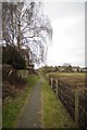

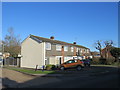
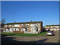
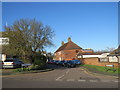
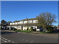
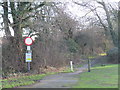

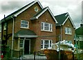
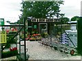
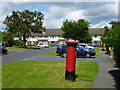
15 photos from this area
Area Information
Key information about the CM15 9QA including its size, population, and administrative classification.
- Area Type
- Postcode
- Area Size
- 1.9 hectares
- Population
- 1411
- Population Density
- 774 people/km²
House Prices in CM15 9QA
56
Properties
£336,444
Average Sold Price
£90,000
Lowest Price
£660,000
Highest Price
Showing 56 properties
| Address | Type | Beds | Baths | Last Sale Price | Last Sale Date | |
|---|---|---|---|---|---|---|
| 124 Hatch Road, Pilgrims Hatch, CM15 9QA | Terraced | 2 | - | £380,000 | Mar 2025 | |
| 126 Hatch Road, Pilgrims Hatch, CM15 9QA | Terraced | 2 | 1 | £370,000 | Sep 2023 | |
| 121 Hatch Road, Pilgrims Hatch, CM15 9QA | Retail | 3 | 2 | £440,000 | Mar 2023 | |
| 109 Hatch Road, Pilgrims Hatch, CM15 9QA | Detached | 4 | 2 | £625,000 | Feb 2023 | |
| 128 Hatch Road, Pilgrims Hatch, CM15 9QA | Terraced | 2 | 1 | £345,000 | Oct 2022 | |
| 98 Hatch Road, Pilgrims Hatch, CM15 9QA | house | 2 | 1 | £370,000 | Oct 2022 | |
| 106 Hatch Road, Pilgrims Hatch, CM15 9QA | house | - | - | £415,000 | Apr 2022 | |
| 93 Hatch Road, Pilgrims Hatch, CM15 9QA | house | - | - | £660,000 | Feb 2022 | |
| 130 Hatch Road, Pilgrims Hatch, CM15 9QA | Terraced | 3 | 1 | £405,000 | May 2021 | |
| 103 Hatch Road, Pilgrims Hatch, CM15 9QA | Bungalow | 2 | - | £490,000 | Apr 2021 |
Page 1 of 6
Energy Efficiency in CM15 9QA
Amenities
Schools
| Rank | School | Type | Entry gender | Ages |
|---|
Explore more schools in this area
Go to Schools tabDemographics
Household Size
Family (3-5 people)
most common
Accommodation Type
Houses
most common
Tenure
87
majority
Ethnic Group
White
most common
Religion
N/A
most common
Household Composition
N/A
most common
Age
47
median
Adults (30-64 years)
most common
Household Deprivation
N/A
with no deprivation
NS-SEC
36
in Lower managerial occupations
Explore more demographic insights in this area
Go to Demographics tabPlanning
Planning Constraints
- Flood RiskPremium
- Ramsar Wetland SitesPremium
- Area of Outstanding Natural BeautyPremium
- Protected Nature ReservePremium
- Protected WoodlandPremium