Area Overview for CM15 9ET
Photos of CM15 9ET
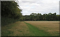

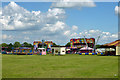

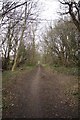
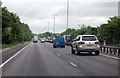
18 photos from this area
Area Information
Key information about the CM15 9ET including its size, population, and administrative classification.
- Area Type
- Postcode
- Area Size
- 8.6 hectares
- Population
- 1650
- Population Density
- 2597 people/km²
House Prices in CM15 9ET
26
Properties
£325,950
Average Sold Price
£123,000
Lowest Price
£530,000
Highest Price
Showing 26 properties
| Address | Type | Beds | Baths | Last Sale Price | Last Sale Date | |
|---|---|---|---|---|---|---|
| 31 Rushdene Road, Brentwood, CM15 9ET | Semi-detached | 3 | 1 | £500,000 | Nov 2024 | |
| 34 Rushdene Road, Brentwood, CM15 9ET | Retail | 2 | 1 | £498,500 | Jul 2022 | |
| 43 Rushdene Road, Brentwood, CM15 9ET | Bungalow | - | - | £515,000 | Nov 2021 | |
| 54 Rushdene Road, Brentwood, CM15 9ET | house | - | - | £390,000 | May 2021 | |
| 52 Rushdene Road, Brentwood, CM15 9ET | Bungalow | - | - | £360,000 | Jan 2019 | |
| 35 Rushdene Road, Brentwood, CM15 9ET | house | - | - | £447,500 | Sep 2017 | |
| 33 Rushdene Road, Brentwood, CM15 9ET | Semi-detached | 4 | - | £530,000 | Mar 2017 | |
| 36 Rushdene Road, Brentwood, CM15 9ET | Semi-detached | 3 | - | £405,000 | Mar 2016 | |
| 40 Rushdene Road, Brentwood, CM15 9ET | Semi-detached | 3 | 2 | £380,000 | Jul 2015 | |
| 51 Rushdene Road, Brentwood, CM15 9ET | Bungalow | - | - | £210,000 | Mar 2014 |
Page 1 of 3
Energy Efficiency in CM15 9ET
Amenities
Schools
| Rank | School | Type | Entry gender | Ages |
|---|
Explore more schools in this area
Go to Schools tabDemographics
Household Size
Family (3-5 people)
most common
Accommodation Type
Houses
most common
Tenure
79
majority
Ethnic Group
White
most common
Religion
N/A
most common
Household Composition
N/A
most common
Age
47
median
Adults (30-64 years)
most common
Household Deprivation
N/A
with no deprivation
NS-SEC
45
in Lower managerial occupations
Explore more demographic insights in this area
Go to Demographics tabPlanning
Planning Constraints
- Flood RiskPremium
- Ramsar Wetland SitesPremium
- Area of Outstanding Natural BeautyPremium
- Protected Nature ReservePremium
- Protected WoodlandPremium