Area Overview for CM15 9DY
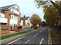
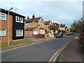
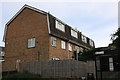
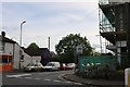
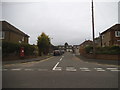
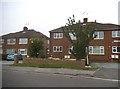
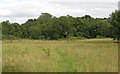
Photos of CM15 9DY

Area Information
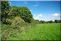
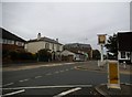
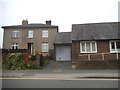
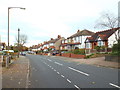
Living in CM15 9DY means being part of a small, tightly knit residential cluster in England’s Essex region. With a population of 1,649, this area is characterised by its compact size and proximity to key transport links. The community is predominantly composed of adults aged 30–64, reflecting a mature demographic with strong ties to homeownership. Over 70% of residents own their homes, many of which are traditional houses, creating a stable, family-oriented environment. The area’s proximity to Brentwood North ward and its coordinates (51.624483, 0.298301) situate it near broader regional hubs, offering a balance between suburban tranquillity and accessible urban amenities. Daily life here is shaped by nearby retail outlets, rail stations, and metro connections, ensuring practicality for commuters and shoppers. While the area lacks large-scale attractions, its small-scale charm and low crime risk make it appealing for those seeking a secure, low-maintenance lifestyle. The absence of environmental constraints such as protected woodlands or Areas of Outstanding Natural Beauty means development is unhindered, though this also means the landscape is unremarkable. For buyers, CM15 9DY offers a straightforward, no-frills option in a region with strong transport networks.
- Area Type
- Postcode
- Area Size
- Not available
- Population
- 1649
- Population Density
- 6739 people/km²
The property market in CM15 9DY is defined by a strong emphasis on owner-occupied homes, with 70% of properties owned by residents rather than rented. This suggests a stable, long-term market with limited rental activity. The accommodation type is predominantly houses, which are more common than flats or apartments. This aligns with the area’s mature demographic, where families and established professionals may prefer the space and privacy of a single-family home. The small size of the postcode area means the housing stock is likely limited, making it a niche market for buyers seeking specific properties. Nearby areas may offer more options, but CM15 9DY itself is unlikely to have significant new developments. For buyers, this means competition could be low, but availability of properties may be restricted. The absence of protected sites or planning constraints also means the area is not subject to restrictions that could limit future development, though this does not necessarily indicate growth in housing supply.
House Prices in CM15 9DY
Showing 3 properties
| Address | Type | Beds | Baths | Last Sale Price | Last Sale Date | |
|---|---|---|---|---|---|---|
| Gate Lodge Cottage, Highwood Hospital, Ongar Road, Brentwood, CM15 9DY | Detached | - | - | - | - | |
| Highwood Hospital, Ongar Road, Brentwood, CM15 9DY | commercial | - | - | - | - | |
| Highwood Surgery, Geary Drive, Brentwood, CM15 9DY | commercial | - | - | - | - |
Energy Efficiency in CM15 9DY
Residents of CM15 9DY have access to a range of nearby amenities, including five retail outlets such as Morrisons, Sainsburys, and Tesco. These stores provide essential shopping options for groceries, household goods, and daily necessities. The area’s rail and metro connections—Brentwood, Shenfield, Harold Wood, Upminster Bridge, and Hornchurch—offer convenient travel to larger towns and cities, supporting both work and leisure activities. While the area lacks large parks or cultural landmarks, its proximity to practical retail and transport hubs ensures a functional lifestyle. The absence of major leisure facilities means residents may need to travel for entertainment, but the convenience of nearby stations makes this manageable. The small-scale nature of CM15 9DY means its amenities are tailored to local needs rather than serving a broader population. This creates a self-contained environment where daily tasks can be completed without long commutes, though the area is not a destination for large-scale shopping or recreation.
Amenities
Schools
| Rank | School | Type | Entry gender | Ages |
|---|
Explore more schools in this area
Go to Schools tabDemographics
CM15 9DY’s population of 1,649 is predominantly composed of adults aged 30–64, with a median age of 47. This suggests a community of established professionals and families, many of whom are homeowners—70% of properties are owner-occupied. The area is largely composed of houses rather than flats, reflecting a preference for single-family dwellings. The predominant ethnic group is White, though specific data on diversity or deprivation is not available. The age profile indicates a mature population, which may influence local services and amenities. With no significant youth or elderly demographics noted, the area’s needs likely align with middle-aged residents. The absence of detailed data on household composition or income levels means broader socioeconomic factors remain unclear, but the high home ownership rate suggests financial stability. This demographic profile positions CM15 9DY as a place where long-term residency and family life are common, with limited evidence of transient populations or high turnover.
Household Size
Accommodation Type
Tenure
Ethnic Group
Religion
Household Composition
Age
Household Deprivation
NS-SEC
Explore more demographic insights in this area
Go to Demographics tabPlanning
Planning Constraints
- Flood RiskPremium
- Ramsar Wetland SitesPremium
- Area of Outstanding Natural BeautyPremium
- Protected Nature ReservePremium
- Protected WoodlandPremium