Area Overview for CM15 9DU
Photos of CM15 9DU
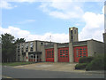
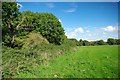
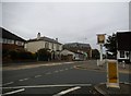
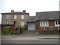
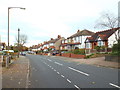
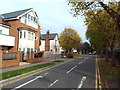
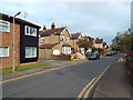
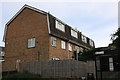
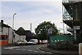
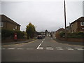
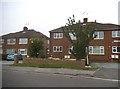
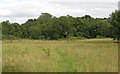
20 photos from this area
Area Information
Key information about the CM15 9DU including its size, population, and administrative classification.
- Area Type
- Postcode
- Area Size
- 7769 m²
- Population
- 1650
- Population Density
- 2597 people/km²
House Prices in CM15 9DU
25
Properties
£387,473
Average Sold Price
£120,000
Lowest Price
£600,000
Highest Price
Showing 25 properties
| Address | Type | Beds | Baths | Last Sale Price | Last Sale Date | |
|---|---|---|---|---|---|---|
| 197 Ongar Road, Brentwood, CM15 9DU | Semi-detached | 3 | 1 | £515,000 | Mar 2025 | |
| 203 Ongar Road, Brentwood, CM15 9DU | Semi-detached | 3 | 2 | £590,000 | Nov 2022 | |
| 191 Ongar Road, Brentwood, CM15 9DU | Semi-detached | 5 | 3 | £600,000 | Jun 2022 | |
| 177 Ongar Road, Brentwood, CM15 9DU | house | 3 | - | £565,000 | Jan 2022 | |
| 195 Ongar Road, Brentwood, CM15 9DU | Semi-detached | 3 | 1 | £406,000 | May 2020 | |
| 211 Ongar Road, Brentwood, CM15 9DU | Semi-detached | 3 | 1 | £420,000 | Dec 2019 | |
| 205 Ongar Road, Brentwood, CM15 9DU | Semi-detached | 3 | - | £400,000 | Mar 2016 | |
| 175 Ongar Road, Brentwood, CM15 9DU | Semi-detached | 3 | 1 | £440,000 | Dec 2015 | |
| 209 Ongar Road, Brentwood, CM15 9DU | Semi-detached | 3 | 1 | £425,000 | Nov 2015 | |
| 215 Ongar Road, Brentwood, CM15 9DU | house | - | - | £515,000 | May 2015 |
Page 1 of 3
Energy Efficiency in CM15 9DU
Amenities
Schools
| Rank | School | Type | Entry gender | Ages |
|---|
Explore more schools in this area
Go to Schools tabDemographics
Household Size
Family (3-5 people)
most common
Accommodation Type
Houses
most common
Tenure
79
majority
Ethnic Group
White
most common
Religion
N/A
most common
Household Composition
N/A
most common
Age
47
median
Adults (30-64 years)
most common
Household Deprivation
N/A
with no deprivation
NS-SEC
45
in Lower managerial occupations
Explore more demographic insights in this area
Go to Demographics tabPlanning
Planning Constraints
- Flood RiskPremium
- Ramsar Wetland SitesPremium
- Area of Outstanding Natural BeautyPremium
- Protected Nature ReservePremium
- Protected WoodlandPremium